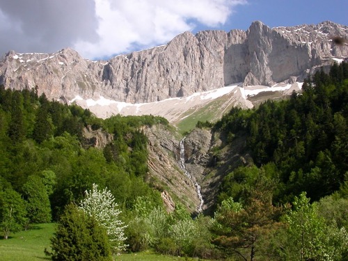
Mougious waterfall
Take a walk along the trails that will take you to the discovery of the Permafrost de Combe Obscure permafrost and the Mougious waterfall, all with magnificent views of the highest peaks of the Drôme. This hike takes place partly in forest but also at times along a torrent.
1 point of interest

Fond de la Jarjatte et le Rocher rond - L.Pascale-LaDromeTourisme Vallon de la Jarjatte
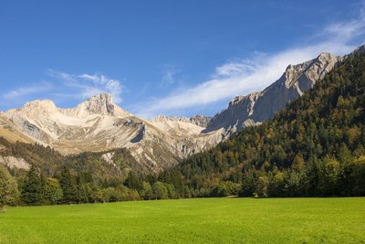
At the foot of the highest summits Drômois and backed up to Dévoluy, the valley of the Jarjatte is a classified site protected since 2012.Between torrent, forest (fir beech forest), alpine pastures and limestone peaks. The meteorology of this sector makes it its richness.The climate of the preharms of the humid north and that of the dry south alps mingle and favor an unusual procession of natural environments.
Description
From La Jarjatte, follow the GR 93 for 400m towards La Plainie 1. From there, take a path in the woods to reach the Permafrost de Combe Obscure 2. Continue until the Pasture of Mougious 3 and its magnificent panorama, before descending to Ravine de la Chaumette 4 (attention strong slope). Then join the Cascade de Mougious 5 at 200 m. Go back to the Ravin de la Chaumette 6 and head towards La Jarjatte via the Combe Bertin 7. Take the road between Combe Bertin and La Jarjatte for 1.6 km.
- Departure : La Jarjatte, Lus-la-Croix-Haute
- Arrival : La Jarjatte, Lus-la-Croix-Haute
- Towns crossed : Lus-la-Croix-Haute
Forecast
Altimetric profile
Sensitive areas
- Impacted practices:
- Sensitivity periods:
- JanFebMarAprMayJunJulAugSepOctNovDec
- Contact:
- https://www.parc-du-vercors.fr/
https://www.paysdiois.fr/
Recommandations
Beware in rainy weather, some technical passages can be delicate and slippery!
Use the passageways to cross the fences, close the gates and barriers, stay on the marked paths.
Information desks
10 Place des Lucioles, 26620 Lus-la-Croix-Haute
Transport
By train :
Lus-la-Croix-Haute train station. OùRA multimodal route planner : https://www.oura.com/
By Bus : Regional bus line n°31 Grenoble-Marseille (via Sisteron and Digne-les-Bains) and stop at Lus-la-Croix-Haute.
Carpooling :
Offer your services or book your carpooling on the regional Mov'Ici platform.
Access and parking
From the E712 take the direction of Lus-la-Croix-Haute. From there take the D505 to La Jarjatte, park in the parking lot at the foot of the station.
Report a problem or an error
If you have found an error on this page or if you have noticed any problems during your hike, please report them to us here:
