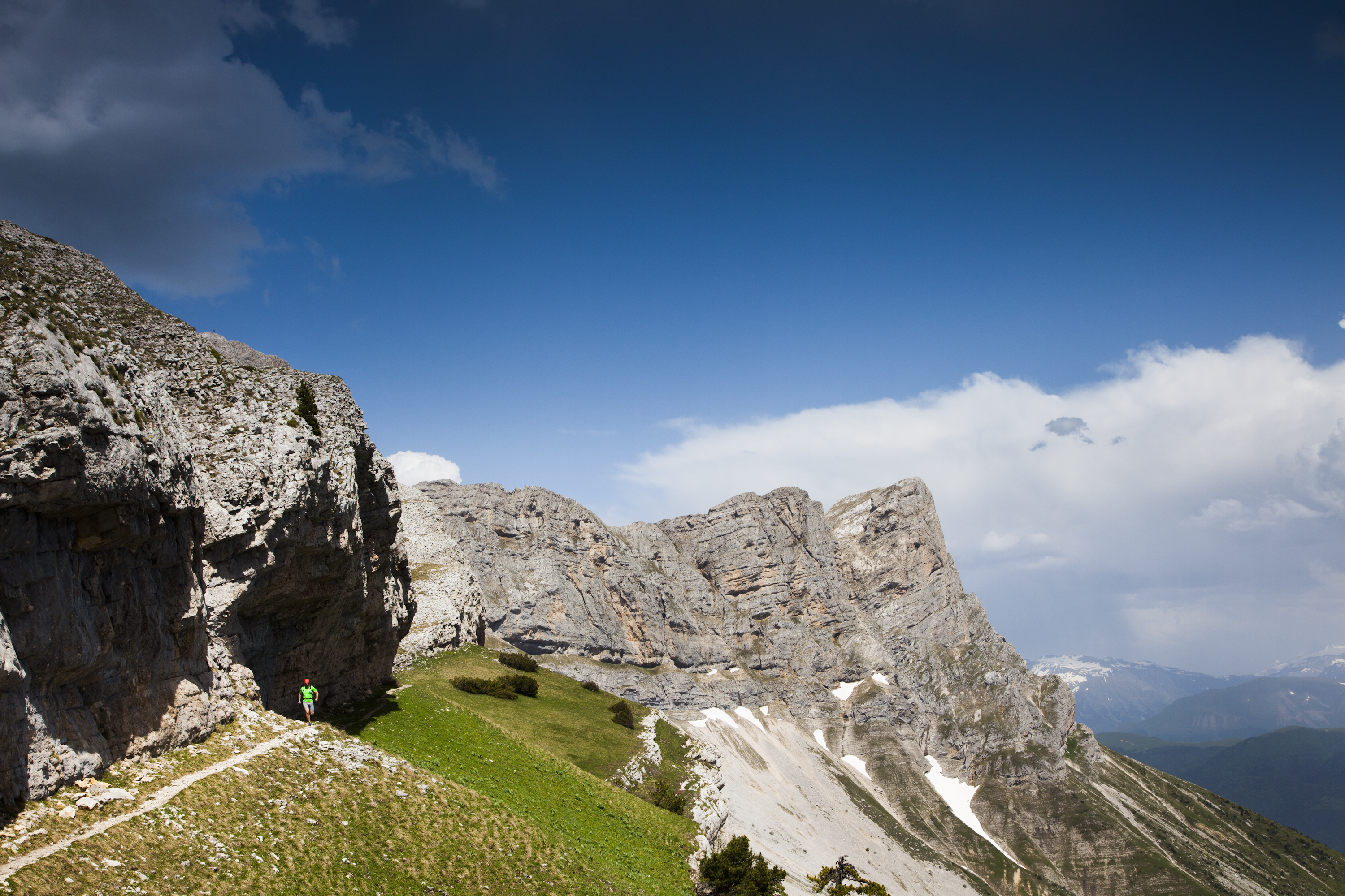
The Balme pass
Château-Bernard

The Balme pass
6h30
18,5km
+1375m
-1371m
Embed this item to access it offline
After a first part in undergrowth, the vegetation becomes more and more rare, in favor of the mineral environment. A nice path and then a simple feeling sometimes a little steep gives access to the Pas de la Balme and its magnificent 360 ° panorama.
1 point of interest
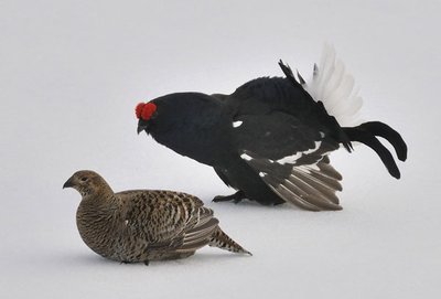
Tétras-Lyre Vercors - PNRV Tétras Lyre (Black Grouse)
This crossroads takes its name from the black grouse. This sedentary bird is one of the symbols of the Vercors Regional Nature Park. It appears on the park's logo, in the company of the wild tulip. During the breeding season (April-May) the cock sings at daybreak. But do not try to see it and above all stay on the roads, because this remarkable species is very sensitive to disturbance.
Description
Departure from Château-Bernard (village) take the direction of Pas de la Balme 8. At La Chapelle 1, climb to the Janas 2 and then join Le Mas 3. The hike continues mainly in the forest until the crossroads Font du Mas 4. From there, follow the forest road to Font Bessou 5 and then take on the right the route that leads gradually to the crossroads Les Poules 6 (always follow the yellow-green markings). Another effort to reach Mulet du Curé 7, the path in narrow laces allows to reach the crest and the Pas de la Balme. To return to the village of Château-Bernard, return to the Mulet du Curé then reach Bois Ras 9 and Tissonier 10. The path continues down into the underbrush and leads to Betrana 11. Continue to Chénevarie 12 then Le Mas Roux 13 and Le Mas before returning to Château-Bernard.
- Departure : Château-Bernard village (parking)
- Arrival : Château-Bernard village (parking)
- Towns crossed : Château-Bernard, Le Gua, and Corrençon-en-Vercors
Forecast
Altimetric profile
Recommandations
Be vigilant in rainy and fogy weather some passages can be slippery.
You are in summer areas, perhaps you will meet protective dogs, often Patous (or mountain of the Pyrenees). Always be sure to bypass the herds, while remaining calm while the dog identifies you, not caressing or threatening them. If you have a dog, keep it on a leash.
You are in summer areas, perhaps you will meet protective dogs, often Patous (or mountain of the Pyrenees). Always be sure to bypass the herds, while remaining calm while the dog identifies you, not caressing or threatening them. If you have a dog, keep it on a leash.
Herd protection dogs
In the mountain pastures, the guard dogs are there to protect the herds from predators.
When I hike, I adapt my behaviour by going around the herd and pausing so that the dog can identify me.
Click here to see the video : c'est quoi au juste un chien de protection ?
Information desks
43, route du Grand-Veymont, 38650 Gresse-en-Vercors
Access and parking
From Grenoble take the A51 south to Monestier-de-Clermont. From there, take the direction of Château-Bernard by the D8 then the D242.
Parking :
Parking village
More information
Report a problem or an error
If you have found an error on this page or if you have noticed any problems during your hike, please report them to us here: