Chemins de la Liberté – The Path to Freedom: The C3 Camp at Gève-les-Carteaux
Autrans


Chemins de la Liberté – The Path to Freedom: The C3 Camp at Gève-les-Carteaux
4h30
10,4km
+444m
-442m
Embed this item to access it offline
Hike mainly forest, which leads to a splendid panorama on the valley of the Isère and the massif of the Chartreuse. You will walk in the middle of many lapiaz.
6 points of interest
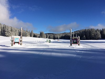
Le plateau de Gève, haut lieu du ski nordique - s_fayollat Gève
The Gève plateau is very popular for Nordic skiing; it forms part of the 200 km network of cross-country ski trails in the Autrans-Méaudre area. In winter, the Gève plateau has some of the highest snowfall in the Vercors.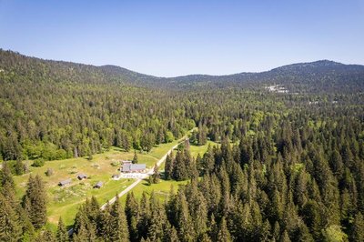
Refuge de Gève - Inspiration Vercors Gève Refuge – Camp 3
Now known as the Refuge de Gève, this forest cabin once served as the winter quarters for the Camp 3 Resistance fighters. It was set up by the Franc-Tireur Resistance movement in the spring of 1943. It housed around 30 people who were refusing to undertake the Service du Travail Obligatoire – the forced enlistment of French citizens. Their days were devoted to collecting firewood and keeping watch. They later took part in the fighting in the Vercors and the Liberation of Lyon in 1944. Since Camp 3 was too easy for the enemy to reach in the summer, it moved to the Cabane des Carteaux.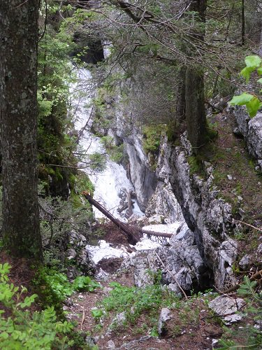
Glacière d'Autrans - PNRV The Glacière of Autrans
The Autrans cooler is a cavity where snow accumulates in the winter and persists for much of the year. It has been traversed by cave explorers for a long time, since 1936 the speleo club of Paris arrives at the depth of -45 meters and it is in 1988 that the siphon terminal is explored in diving to -221 meters. Its karst network develops thanks to an enormous fault. Its resurgence is the Goule Noire (in the gorges of the bourne) distant of 18,5 km!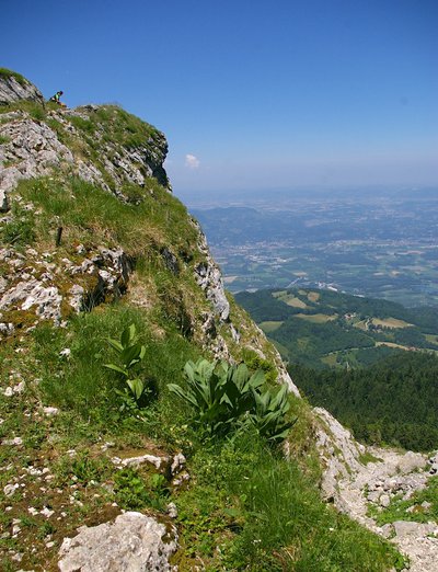
Vue du Pas de la Clé - T. Rony Pas de la Clé
In 1944, following the Normandy landings, the call to arms went out in the Vercors. A watch was kept over the mountain passes across the entire massif to warn about a German attack. The Pas de La Clé was kept under surveillance by eight C3 fighters. In days gone by, the wood from the villages of Autrans and Méaudre was transported to the Pas de la Clé, where it was hurled into a purpose-built corridor before sliding down to Montaud and Veurey. The trunks were collected together on timber rafts on the Isère before being floated towards Beaucaire and the coast.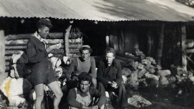
Marc Serratrice Les Carteaux
Summer billeting of the C3 Resistance members in 1943 and 1944. A makeshift hut built of sheet metal and branches gave the fighters shelter. Their days were made up of physical exercise and weapons training before the first battles of June 1944. The hut fell into ruin before being renovated in 2023 by the Cabane 44 association.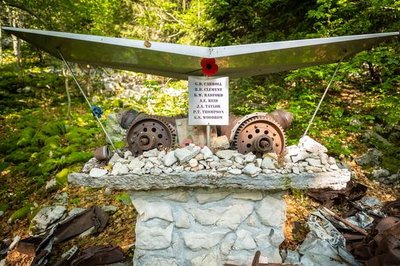
Stèle de l'Avion - Focus outdoor The plane
During the night of 2 February 1944, the Lancester aircraft of the Royal Air Force refueled the resistance of the Camp de Gève. The plane flying at low altitude is caught in a snowstorm, it crashed with its 7 men. The explosion was heard until the village of Autrans. The men still rest today in the cemetery of Autrans.
Description
- Starting from the Gève car park, head towards Pas de la Clé via Le Refuge, La Patte d'Oie, Le Cyclone, La Vira Gros-Jean and Les Gelinottes (with the option of doing a round trip at La Glacière at 500 meters).
- At Pas de la Clé, head for Bec de l'Orient via Sous le Pas Brochier and Pas Brochier.
- After Bec de l'Orient head to La Cheminée, L'Avion, Charbonnière and on to Haut du Canyon. Walk back to the Gève car park via Le Refuge.
- Departure : Gève, Autrans
- Arrival : Gève, Autrans
- Towns crossed : Autrans
Forecast
Altimetric profile
Sensitive areas
Along your trek, you will go through sensitive areas related to the presence of a specific species or environment. In these areas, an appropriate behaviour allows to contribute to their preservation. For detailed information, specific forms are accessible for each area.
Golden eagle
- Impacted practices:
- , ,
- Sensitivity periods:
- JanFebMarAprMayJunJulAug
- Contact:
Recommandations
Use the passageways to cross the fences, close the gates and barriers, stay on the marked paths.
Staying on marked paths also means respecting private property.
Staying on marked paths also means respecting private property.
Information desks
49 route du Vercors, 38880 Autrans-Méaudre-en Vercors
Transport
By bus : With Region T65 or T64 coaches for Lans-en-Vercors and then on line T66 to Autrans. Please note that line T66 does not go further than Autrans. There is the option of finishing the walk at the car park by hitchhiking or carpooling.
By hitch hiking : You can get there / get back by hitching a lift with the Rezo Pouce network from Autrans-Méaudre, Lans-en-Vercors, Grenoble and Royans-Vercors (you can find all the stops in the Vercors on www.rezopouce.fr).
Carpooling :
Offer your services or book your carpooling on the regional Mov'Ici platform.
Access and parking
From Grenoble take the D531 to Lans-en-Vercors, then take the direction of Autrans via the D106. In Autrans head towards the Nordic domain of Gève.
Parking :
Parking at the entrance of the plateau de Gève
More information
Report a problem or an error
If you have found an error on this page or if you have noticed any problems during your hike, please report them to us here: