The Saint-Michel peak and the Arc pass
Lans-en-Vercors

The Saint-Michel peak and the Arc pass
4h30
9,8km
+706m
-706m
Embed this item to access it offline
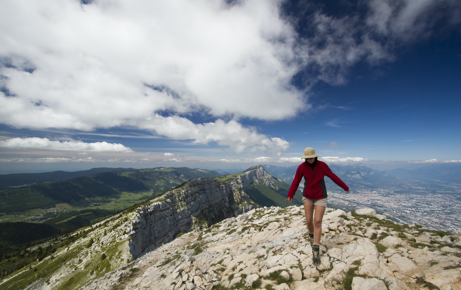
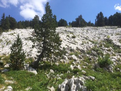
This pleasant mountain hike will let you discover different environments in a sumptuous setting. You will wander through the woods, alpine pastures and the lapiaz.
2 points of interest
m_rocheblave 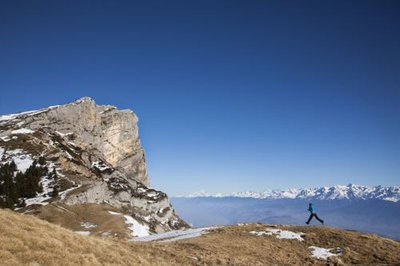
Col de l'Arc - S&M Booth
Description
Leaving from the lieu-dit Les Barnets (car park), go towards the Pic Saint-Michel by taking the Tour des Quatre-Montagnes itinerary (yellow and red marking). At the Collet du Furon, take the trail that climbs to the Combe Oursière now following the yellow-green markers. This trail meanders amongst the rocks to finally reach the Pic Saint-Michel with its magnificent panorama over the Grenoble valley and a large part of the Alps. After a good rest, even if only to appreciate the beauty of the location, the walk continues close to the ridge, regularly descending to reach the Col de l'Arc, the other highlight of the circuit. To return to the Barnets, follow the marked trail and descend to Font Froide where you meet the GR 91. From there, go to La Salière then the Collet du Furon, from which the Barnets is not far.
- Departure : Barnets car park, route des Montagnes de Lans, Lans-en-Vercors
- Arrival : Barnets car park, route des Montagnes de Lans, Lans-en-Vercors
- Towns crossed : Lans-en-Vercors, Claix, Varces-Allières-et-Risset, Saint-Paul-de-Varces, and Villard-de-Lans
Forecast
Altimetric profile
Sensitive areas
Along your trek, you will go through sensitive areas related to the presence of a specific species or environment. In these areas, an appropriate behaviour allows to contribute to their preservation. For detailed information, specific forms are accessible for each area.
Golden eagle
- Impacted practices:
- , ,
- Sensitivity periods:
- JanFebMarAprMayJunJulAug
- Contact:
Recommandations
At certain times of year, you will cross summer pastures, and may meet herd protection and guard dogs (Patous). Always ensure that you go a long way round the animals, calmly so that the dog can identify you, do not pat or threaten them. Keep dogs on leads.
In rainy weather, some technical sections may be difficult and slippery!
Use the installed passages to cross fences, close gates and barriers.
Stay on the marked trails and respect private property.
Information desks
246 avenue Léopold Fabre, 38250 Lans-en-Vercors
Transport
By train : Grenoble train station
The OùRA multimodal route planner provides information about all the connections between regional trains, urban transport and departmental bus lines : https://www.oura.com/
By bus : With Regional coaches T65 or T64 to Lans-en-Vercors village. Please note that you will have to reach the start walking or hitch hiking.
By hitch hiking : You can get there / get back by hitching a lift with the Rezo Pouce network from Autrans-Méaudre, Lans-en-Vercors, Grenoble and Royans-Vercors (you can find all the stops in the Vercors on www.rezopouce.fr).
Carpooling :
Offer your services or book your carpooling on the regional Mov'Ici platform.
Access and parking
From Lans-en-Vercors, head towards the Sierre (Montagnes de Lans snow stadium) via the D1061, park in the "Les Barnets" car park.
Parking :
Barnets car park, (route des Montagnes de Lans)
More information
Report a problem or an error
If you have found an error on this page or if you have noticed any problems during your hike, please report them to us here: