The path around Chevalet
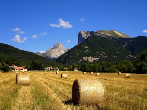
Lus-la-Croix-Haute

The path around Chevalet
3h30
8,7km
+534m
-530m
Embed this item to access it offline
The alpine pastures offer a bucolic setting for this hike all in perspective: open view, feel fullness, privileged field of observation of griffon vultures and alpine fauna in general.
3 points of interest
Seuil RTM - PNRV RTM Works
In 1860, the Mountain Range Restoration (RTM) services were created, in order to avoid excessive erosion and runoff phenomena, causing torrential lava flows. In order to do so, a policy of reforestation has been launched, as well as the setting of thresholds in the areas of flow. The restoration was particularly important in the Diois.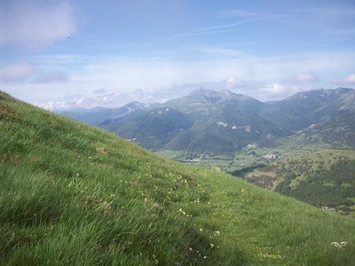
Point de vue col de Tournerond - PNRV Col de Tournerond
One of the mountainous borders between the Trièves and the Diois, the Col de Tournerond offers a view of the peaks and ridges surrounding: the Rogon, the Jocou ...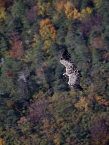
vautour fauve à l'automne - S&M Booth Griffon vulture
Perhaps you will have the chance to observe the griffon vulture. Reintroduced in the Vercors in 1999, this scavenger can weigh more than 10 kilos and have a wingspan up to 2m80. The vultures search where the herds are, in search of food.
Description
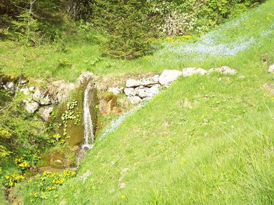
At the Pont des Amayères (parking), take the path that enters the gorges towards the Bergeries des Amayères 1. To the sheepfolds, the valley separates in two, take the left one which goes towards the Valle de Tranchemule 2, go along a small stream. After crossing the Vallon de Tranchemule, the trail stiffens to reach the Col de Tournerond 3. Join the Col de la Chante 4 crossing the alpine slopes to your right. Once on the ridge, you will descend to the pass. Leave the ridge and descend into the hollow of the valley to reach La Cassa 5. The trail, leading to the foot of the Chevalet mountain, widens and continues for a moment flat, then descends to the crossing of the Reservoir 6. From there, continue straight, cross the hamlet of Sièzes 7 and Chemin des Miellons 8. In the first turn of the road, a path allows to cut the laces to join the Pont des Amayères more quickly.
- Departure : Pont des Amayères, Lus-la-Croix-Haute
- Arrival : Pont des Amayères, Lus-la-Croix-Haute
- Towns crossed : Lus-la-Croix-Haute
Forecast
Altimetric profile
Recommandations
You are on summery areas, maybe you will meet protective dogs, often Patous. Always make sure to bypass the herds, while remaining calm the time the dog identify you, do not pet or threaten them. If you have a dog, hold it on a leash.
Use the passageways to cross the fences, close the gates and barriers out of respect for pastoral and agricultural activities.
Stay on the marked paths is also respect private property.
Be careful, the route is mainly in the mountain pastures, the trail is sometimes not very marked and may be confused with the traces left by the herds.
Herd protection dogs
In the mountain pastures, the guard dogs are there to protect the herds from predators.
When I hike, I adapt my behaviour by going around the herd and pausing so that the dog can identify me.
Click here to see the video : c'est quoi au juste un chien de protection ?
Information desks
10 Place des Lucioles, 26620 Lus-la-Croix-Haute
Transport
By train : Lus-la-Croix-Haute train station : OùRA multimodal route planner : https://www.oura.com
By bus : Regional coaches line n°31 Grenoble-Marseille passing via Lus-la-Croix-Haute
Transport on demand :
Booking : +334 8000 7000
The day before, before 5 pm (on friday before 4 pm to book for saturday)
Regular service (planned schedule)
Connection service
By bus : Regional coaches line n°31 Grenoble-Marseille passing via Lus-la-Croix-Haute
Transport on demand :
Booking : +334 8000 7000
The day before, before 5 pm (on friday before 4 pm to book for saturday)
Regular service (planned schedule)
Connection service
Access and parking
From the E712 / D1075, take the D505 towards Lus-la-Croix-Haute, then follow the D753 towards "Amayères".
Parking :
Close to the Pont des Amayères
Report a problem or an error
If you have found an error on this page or if you have noticed any problems during your hike, please report them to us here: