The Grand Veymont from the Beure plateau

Saint-Agnan-en-Vercors

The Grand Veymont from the Beure plateau
11h
30,8km
+1664m
-1663m
Embed this item to access it offline
This long hike is one of the most beautiful in the Vercors. You will gradually leave the slopes of the Col de Rousset station to reach the large wilderness of the Hauts-Plateaux du Vercors. The forest gradually gives way to pastures and their bucolic atmosphere. As the climb towards the Grand Veymont, the environment becomes more and more mineral, it is the domain of the ibexes that you will perhaps have the chance to observe. From the summit, the panorama is grand.
4 points of interest
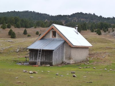
Pré Peyret - PNRV At the crossroads of several important trails, the Cabin de Pre Peyret is one of the most frequented of the massif. Located at the entrance of the high plateaus at 1600 m, this unguarded stone hut can accommodate 10 people for the night. It has a stove.The place exudes an old tradition of welcome because it is an old cabaret where those who were penniless went to drink at the Fountain of the Endettés, which bears his name well.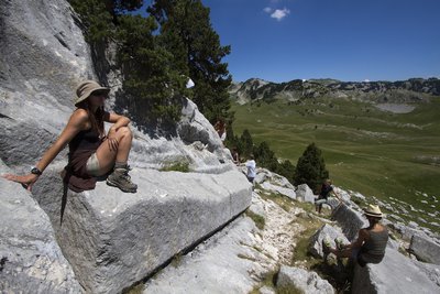
Carrières romaines de la plaine de la Queyrie - S. et M. Booth The Roman quarries
To the north-east of the Pre Peyret hut, on the Queyrie plain, an attentive eye can discover the remains of Roman quarries: fragments of columns, broken rocks ... Nearly 2,000 years ago, The man exploited this hard limestone, cut it on the spot, to descend it to Die by the Pas de Chabrinel. All this with more than rudimentary means ....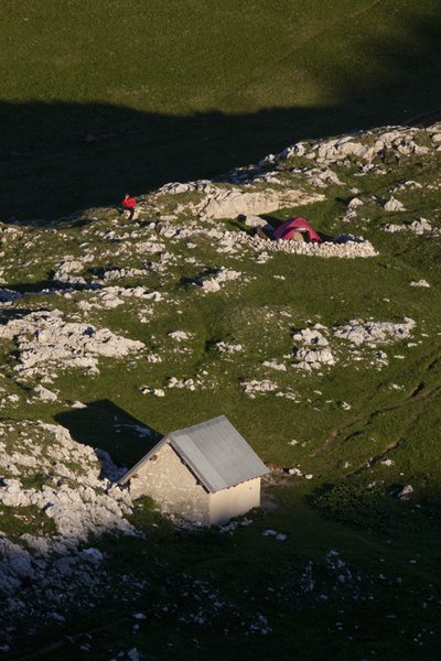
Cabane des Aiguillettes - S.M Booth Cabane of Aiguillettes
The cabin of the Aiguillettes is a former shepherd's hut dating back to the time when the pastoral units were smaller. This hut, open to the public, accommodates only 4 people by tightening a little and does not have a stove.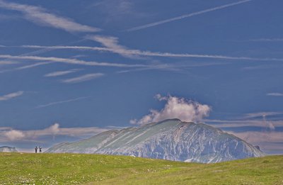
Le Grand Veymont vu du plateau de Beure - E. Charron The Grand Veymont
The highest point of the Vercors with its 2341 m, the Grand Veymont dominates the Trièves in the east and the Hauts Plateaux of the Vercors in the west. It is a continuation of the eastern barrier of the Vercors. It is limited to the north by the Pas de la Ville (1925 m), which allows the link between the Hauts-Plateaux and the Trièves, and to the south by the Pas des Chattons (1828 m). Included in the Hauts-Plateaux reserve of the Vercors, it hosts a rich biodiversity, including numerous ibexes.
Description
The departure of this magnificent hike takes place at the Parking de Beure. 1, où une magnifique vue sur le massif vous attend.">Climb towards the Belvedere 1, where a magnificent view of the massif is waiting for you. 3 par le GR 93, en passant par le Pas des Econdus 2.">From there, follow Pre Peyret 3 by the GR 93, passing by the Pas des Econdus 2. Be careful, you will enter the Hauts-Plateaux du Vercors Nature Reserve. Open to all, this space of freedom requires to be protected, respected and placed under the benevolence of each visitor. Voluntarily low development and restricted mark-up require some commitment on the ground. From Pre Peyret, the path is no longer marked, but is well marked, continue east-northeast, you will gradually climb to reach the vast plain of Queyrie. Continue on your way to the northeast (well-marked path), Mont-Aiguille will then offer you to the east, after a short descent join the foot of the Grand Veymont (towards the north) which stands in front you. 4 à 2341 m.">The path goes up in laces, then in a more rectilinear way to reach the summit 4 at 2341 m. 5 présente quelques passages délicats.">The descent towards the Pas de la Ville 5 presents some delicate passages. 6 et le GR91, suivre le GR vers le sud pour une longue traversée des Haut-plateaux (8 km) et rejoindre Pré Peyret.">From the Pas de la Ville, take the direction of the west, to join La Chau 6 and the GR91, follow the GR towards the south for a long crossing of Haut-plateaux (8 km) and join Pré Peyret. From there, the return journey takes place on the same route as on the way.
- Departure : Beure parking, Saint-Agnan-en-Vercors
- Arrival : Beure parking, Saint-Agnan-en-Vercors
- Towns crossed : Saint-Agnan-en-Vercors, Gresse-en-Vercors, and Chichilianne
Forecast
Altimetric profile
Sensitive areas
Along your trek, you will go through sensitive areas related to the presence of a specific species or environment. In these areas, an appropriate behaviour allows to contribute to their preservation. For detailed information, specific forms are accessible for each area.
Large plateaus at an average altitude of 1,600m, these landscapes are well-known to lovers of wide open spaces where humans have discreetly left their mark over the centuries. The fauna and flora also appreciate these places, where you can observe the two emblems of the Park: the wild tulip and the black grouse. Rock birds particularly appreciate the large cliffs that border these plateaus, and mountain orchids brighten the sparse mountain pine forest. Classified as a National Nature Reserve since 1985, this heart of nature benefits from strong protection. Human activities are regulated, and certain rules apply to everyone: dogs are prohibited, even on a leash; fires are also prohibited, as are motor vehicles, except for professionals (shepherds and breeders, forest managers, and rangers); bivouacking is possible, but tents must be taken down every day. Overflight is prohibited below 300m
- Impacted practices:
- , ,
- Sensitivity periods:
- JanFebMarAprMayJunJulAugSep
- Contact:
- https://www.parc-du-vercors.fr/
Black grouse - winter
- Impacted practices:
- , , ,
- Sensitivity periods:
- JanFebMarAprDec
- Contact:
Recommandations
Please note that you will enter the Hauts-Plateaux du Vercors Nature Reserve, with specific regulations to know and respect!
If possible, do not practice this loop in foggy weather and have a compass and 1/25 000 card.
You are on summery areas, maybe you will meet protective dogs, often Patous. Always be sure to bypass the herds, while remaining calm while the dog identifies you, not caressing or threatening them.

If possible, do not practice this loop in foggy weather and have a compass and 1/25 000 card.
You are on summery areas, maybe you will meet protective dogs, often Patous. Always be sure to bypass the herds, while remaining calm while the dog identifies you, not caressing or threatening them.
Herd protection dogs
In the mountain pastures, the guard dogs are there to protect the herds from predators.
When I hike, I adapt my behaviour by going around the herd and pausing so that the dog can identify me.
Click here to see the video : c'est quoi au juste un chien de protection ?
National nature reserve of Vercors Hauts plateaux
The national nature reserve of Vercors Hauts plateaux is an unrestricted natural area but subjected to regulations which must be known by all visitors. This reserve, created in 1985 by the French government, is the heart of the Vercors Park, with no permanent habitations or roads running through it. Unique in its size (17,000 hectares), the Hauts-Plateaux du Vercors reserve covers 8% of the Vercors Regional Nature Park. It is now the largest terrestrial reserve in mainland France.
It is open to all, but it's subject to a number of regulations that you will need to be aware of to prepare for your stay.
Information desks
Place Pietri, 26 420 La Chapelle-en-Vercors
Access and parking
From Chapelle-en-Vercors, follow the direction of the Col de Rousset via the D518, going through Saint-Agnan-en-Vercors. From the station of Col de Rousset, take the direction of the Plateau de Beure by the D815, ample parking on site.
From Die, take the Col de Rousset on the D518. From the resort of Col de Rousset take the direction of the Plateau de Beure by the D815, ample parking on site.
From Die, take the Col de Rousset on the D518. From the resort of Col de Rousset take the direction of the Plateau de Beure by the D815, ample parking on site.
Parking :
Parking of the plateau de Beure
Report a problem or an error
If you have found an error on this page or if you have noticed any problems during your hike, please report them to us here: