The Ambel plateau (Royans Vercors n°52)

Léoncel


The Ambel plateau (Royans Vercors n°52)
3h30
22,7km
+1035m
-1022m
Embed this item to access it offline
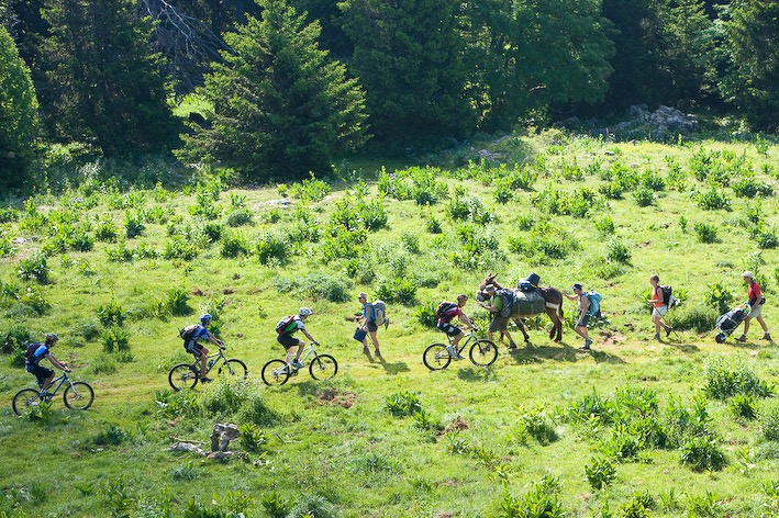
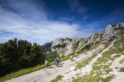
Guaranteed sensations and breathtaking scenery, rolling sections interspersed with technical passages on singles, an unforgettable sporting route.
1 point of interest

Col de la Bataille - S.M Booth Col de la Bataille
Several hypotheses exist as to the origin of the name of the Col de la Bataille. It could be that the name comes from the conflict between the monks of Leoncel and the monks of the other slope for the supremacy of the breeding Ovin. Another hypothesis evokes the confrontation between the winds of the North and the winds of the South.
Description
- Departure from the parking lot of Grand Echaillon, take the direction of the Col du Lion. Always follow the MTB beacons n°52 in black and the yellow and green markings between each directional sign. Continue on the itinerary of the Grand Tour du Vercors passing by Gampaloux and then gradually start the beautiful descent to Bouvante-le-Haut.
- From there, continue south through Logue before going up the Toulau creek. Beware in rainy weather, some passages can be delicate and slippery until the famous Saut de la Truite
- At Gardiol parking lot, be careful you enter the Ambel estate, classified as a Natural Area Sensitive, regulations must be observed! Join the Ambel Refuge via the Combe de la Louvaterre and Le Verâtre.
- At the Pas du Gouillat, bypass the Roc de Toulau to reach the Col de la Bataille by the GR 93. Finish this magnificent loop by driving to La Pelouse de la Sausse then Echaillon sheepfold.
- Departure : Place name Le Grand Echaillon (parking)
- Arrival : Place name Le Grand Echaillon (parking)
- Towns crossed : Léoncel, Bouvante, and Omblèze
Forecast
Altimetric profile
Sensitive areas
Along your trek, you will go through sensitive areas related to the presence of a specific species or environment. In these areas, an appropriate behaviour allows to contribute to their preservation. For detailed information, specific forms are accessible for each area.
Amber plateau summer pasture
Alpine pasture partially grazed and protected from June to September; only herding dogs are allowed on the alpine pasture during the summer period.
- Impacted practices:
- ,
- Sensitivity periods:
- JunJulAugSep
- Contact:
- Association de Développement et d’Économie Montagnarde de la Drôme accueil@adem-drome.fr
Parc du Vercors info@pnr-vercors.fr
Golden eagle
- Impacted practices:
- , ,
- Sensitivity periods:
- JanFebMarAprMayJunJulAug
- Contact:
Summer pasture of La Bataille pass (Col de la Bataille)
Alpine pasture without guard dogs
- Impacted practices:
- , ,
- Sensitivity periods:
- JunJulAugSep
- Contact:
- Association de Développement et d’Économie Montagnarde de la Drôme accueil@adem-drome.fr
Parc du Vercors info@pnr-vercors.fr
Recommandations
Be careful when crossing the cliffs. You will cross part of the regulated departmental area of Ambel, picking flowers is prohibited. Similarly on a large part of the circuit, dogs are prohibited by departmental decree from May 1 to October 30, even on a leash. Thinking about closing the gates of the parks is also to think of the shepherds and the flocks!
Herd protection dogs
In the mountain pastures, the guard dogs are there to protect the herds from predators.
When I hike, I adapt my behaviour by going around the herd and pausing so that the dog can identify me.
Click here to see the video : c'est quoi au juste un chien de protection ?
Information desks
13 Place de l'Eglise, 26190 Saint-Jean-en-Royans
Access and parking
From Saint-Jean-Royans, follow the D70 through Oriol-en-Royans. At Léoncel, take the D199 D199 on the left towards Col de la Bataille.
Parking :
Place name Le Grand Echaillon
Report a problem or an error
If you have found an error on this page or if you have noticed any problems during your hike, please report them to us here:
