Archeotrail: the hunters of Prehistory
A circuit with captivating and varied landscapes. Perhaps you will have the chance to see chamois, marmots or other species occupying these places, in the middle of a natural environment still rich and preserved.
5 points of interest
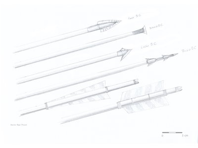
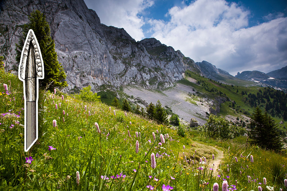
Pointes de flèches et empennages - R. Picavet The outcrops of flint of Plâtres
The flint of the Plâtres, like that of the rest of the region, has been sought by prehistoric men who used it to make their tools.The north of the Vercors is characterized by the abundance of the lodgings in the Quatre-Montagnes area, to which the outcrop of the Plâtres Senonian flint belongs.The search for the geographical origin of flints carved by men during Prehistory can make it possible to understand the circulation of human groups within the territories they frequented.
Vue du sentier Gobert sous le plateau du Cornafion - R. Picavet Roybon
Between the rocks of Ranc des Agnelons and the rock of the Cornafion (2,049 m), at the foot of the Vert pass, is the site of Roybon, frequented by the hunters of the Mesolithic towards 7,000 years before. J-C.More than 500 flakes, tools and armor of flint arrows were found near the creek. The raw material is essentially local. The presence of a quartz shard from the Alpine crystalline massifs shows the mobility of these human groups.Thus, the presence of water in Roybon certainly favored the stay of prehistoric men on the site during their ibex hunting expeditions.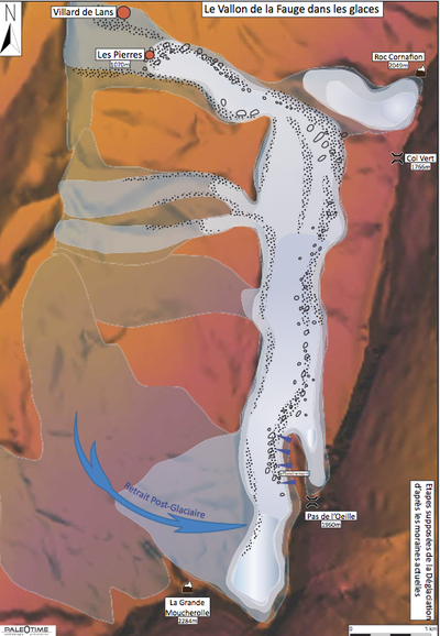
Ancien glacier de la Fauge - Paléotime Point of view of the Côtes
The panoramic view allows you to gaze at the landscape as sculpted by the glaciers.This landscape is marked by the presence of external lateral moraines forming parallel cords, originating from rocks torn off and transported by the glacier that occupied the valley of Fauge 20 000 years ago.Some erratic blocks, which are found in the center of the village of Villard-de-Lans, have been transported by this glacier and come from the ridge between Pas de l'Œille (1960 m) and Pré Achard .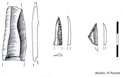
Silex taillé - R. Picavet Clos de Lans area
Not far from the cold Font fountain and the path that leads to the Col de l'Arc is a south-facing slope. Sheltered by the wind, it was frequented by prehistoric men around 10,000 BC. , as the glaciers disappeared.More than 1,000 objects in flint were discovered as a result of work carried out for the capture of the nearby fountain. Most of these objects were fashioned on flint found at the foot of the slopes of the Cornafion.It is the presence of water and flint, as well as the good exhibition of the site that attracted the hunters of Prehistory on this place, which presents a small flint-sized workshop.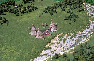
Maquette reconstituant le site de Machiret - R. Picavet Machiret
At the foot of the Black Combe, on the site of the fountain of Machiret, several thousands of objects in flint were discovered following the erosion of the path of the Col de l'Arc.The site was frequented during the Mesolithic period (9,500-6,500 BC). Some of the objects are shaped from the flint present on the slopes of the Cornafion. However, some of these pieces are made of flint from the south of the Vercors. Others are made of hyaline quartz and come from the crystalline Alps.This shows the great mobility of the last hunters of Prehistory, who found here a propitious place to stay during their hunting expeditions at altitude.
Description
Departure from the village center of Villard-de-Lans, near the Maison du Patrimoine. 1.">Go up the pedestrian street, take the Rue de l'Adret to join Les Lèches 1. At the primary school, turn right into "Rue du Professeur Debré" and then "Avenue Empress Zita" before turning left onto "Chemin des Pierres". At the top of this street, turn left again onto the "Chemin des Blachons". 2 puis Champ Gressaud 3, toujours bien suivre les marques de balisage jaunes et vertes. ">Continue along the chemin de la Fauge to reach Le Dessus du Corps 2 and then Champ Gressaud 3, always follow the yellow and green markings.
4.">From there, take the direction of Les Cochettes but turn quickly on the right, the road leading to the Cross Plaster 4. 5 et Roybon 6 où une halte est toujours très appréciée.">Continue to Plâtres 5 and Roybon 6 where a stop is always very appreciated. 7, continuer sur le GR 91 plein nord en passant à Lurbeillet 8, le très beau sentier en balcon vous conduit à Combe Chaulange 9.">At the Source of Roybon 7, continue on GR 91 due north to Lurbeillet 8, the beautiful balcony trail leads you to Combe Chaulange 9. 10.">While admiring a landscape as varied as spectacular, reach Font Froide 10. 11.">Leave the GR and the Tour de Pays des Quatre-Montagnes and follow the road to the north, going down towards Villard-de-Lans on the Prairies of Machiret 11. 12, passer par Les Espinasses 13 et La Conversaria 14 puis rallier Les Mourets 15 et un peu plus bas La Cote 1010 mètres 16.">At La Ya 12, go through Les Espinasses 13 and La Conversaria 14 and then join Les Mourets 15 and a little lower La Cote 1010 meters 16. 17, le centre de Villard-de-Lans, point de départ de cette magnifique randonnée, n'est alors plus très loin.">At the level of Les Vières 17, the center of Villard-de-Lans, starting point of this magnificent hike, is then far away.

Find more information in the guide Vercors, land of prehistory, available in bookshop and in the shop of the Park
- Departure : Maison du patrimoine (center of Villard-de-Lans)
- Arrival : Maison du patrimoine (center of Villard-de-Lans)
- Towns crossed : Villard-de-Lans and Lans-en-Vercors
Forecast
Altimetric profile
Sensitive areas
Black grouse - winter
- Impacted practices:
- , , ,
- Sensitivity periods:
- JanFebMarAprDec
- Contact:
Recommandations
Use the passageways to cross the fences, close the gates and barriers.
Staying on marked trails also means respecting private property.
Beware of rain or fog, some passages can be slippery and technical.
You will be going through the summer pastures, maybe you will meet protective dogs and herd guards.
Always be sure to bypass the animals while remaining calm while the dog identifies you. Do not pet him or threaten him.
If you have a dog, keep it on a leash!
Information desks
101 place Mure-Ravaud, 38250 Villard-de-Lans
Transport
By train : Grenoble train station
By bus :
Villard de Lans can be reach from Grenoble with regional lines T64 or T65 which both goes from Grenoble to Villard-de-Lans.
By hitchhiking :
Find all the official hitchiking spots on www.rezopouce.fr
By carpooling :
Offer your services or book your carpooling on the regional Mov'Ici platform.
Access and parking
After the motorway toll of Voreppe, take the exit Villard-de-Lans (RN 532); Before the village of Sassenage, take direction Vercors on the right. At Lans-en-Vercors, follow the D 531 towards Villard-de-Lans.
From the south, after the motorway toll of the Baume d'Hostun, follow Saint-Nazaire en Royans then take the RD 531, direction Villard-de-Lans.
Parking :
More information
Report a problem or an error
If you have found an error on this page or if you have noticed any problems during your hike, please report them to us here: