Châtillon-en-Diois / Die (stage 8)
Châtillon-en-Diois
Châtillon-en-Diois / Die (stage 8)
7h
20,3km
+1311m
-1467m
Embed this item to access it offline
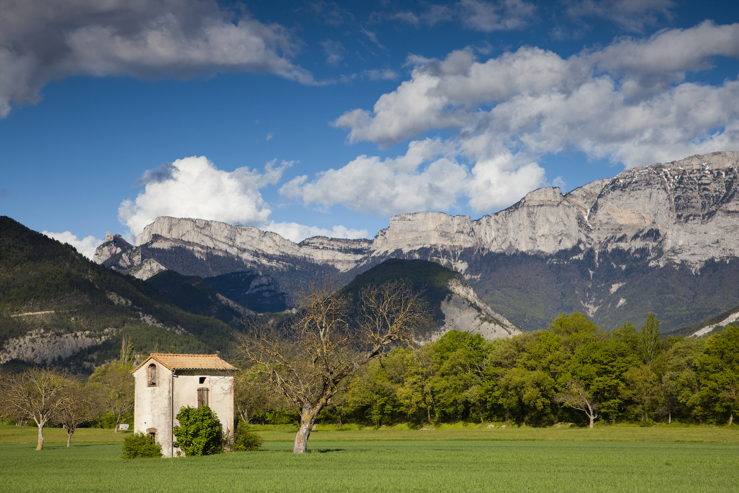
Setting off from Châtillon-en-Diois, this hike, which passes partly through forest, boasts a plethora of wonderful views not just over the majestic cliffs of Mount Glandasse, but also the village and vineyard of Châtillon.
5 points of interest
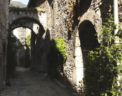
Les "viols" de Châtillon-en-Diois - S. et M. Booth Châtillon-en-Diois
Nestled at the foot of the most southern cliffs of the Vercors, this medieval village has preserved from its past narrow streets called "rapes" and 17 fountains with stone basins on which climb the plants of the botanical village.Capital of canton along the river Le Bez, Châtillon-en-Diois offers all shops and services, a swimming pool and many festivities during the summer season. Its vineyard, one of the highest in France, produces red, white and rosé wines with an Appellation d'Origine Contrôlée.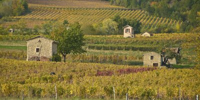
Cabanons dans les vignes de Châtillon - Fabien da Costa (m) View of the Châtillon vineyard
The Châtillon-en-Diois vineyard produces wines of Appellation d'Origine Contrôlée (AOC). It comprises only 65 hectares of vines, making it one of the smallest appellations. The vineyard extends over the foothills of the Vercors, which protects it from the winds of the North. It produces red and rosé wines from gamay syrah and pinot noir grapes, as well as white wine from aligoté and chardonnay grape varieties.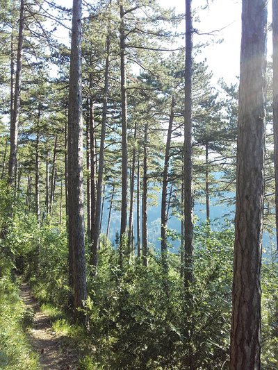
La forêt de pins du Glandasse - M. Morin The forest of Glandasse
The state forest of Glandasse covers more than 21 km². Under Mediterranean influence, there are mainly oaks and black pines. The latter, because of their relative rusticity and good tolerance to the soil, were a kind of choice in the reforestation work as part of the Mountain Restoration Policy (RTM) Administration of Water and Forests at the beginning of the twentieth century to fight erosion of the slopes.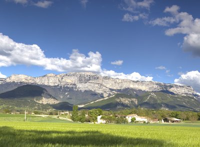
La montagne de Glandasse vue depuis la plaine - S.M Booth Glandasse
The mountain of Glandasse dominates the Diois from the top of its 2,041 meters. Its cliffs are popular for climbing, while the plateau at its summit is a place of estive for many sheep. Included in the nature reserve of the Hauts Plateaux of the Vercors, the fauna and flora are rich. From the Col des Caux, it is the Roc d'Ambane (1,958 m) that stands in front of you.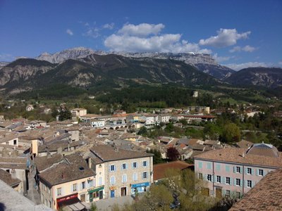
Die - m_rocheblave Die
The capital of the Diois, on the banks of the river Drôme, is dominated by the Glandasse. The old center is surrounded by a rampart of the 3rd century and conceals architectural treasures: Gallo-Roman ramparts, door Saint-Marcel, Romanesque mosaic. The immense Notre-Dame Cathedral is the witness of the prestigious past of the city. On the sunny hillsides, vineyards and limestone can be heard wonderfully to give the famous Clairette de Die.
Description
After Châtillon-en-Diois, the Grand Tour du Vercors makes its way towards Die via the foot of Mount Glandasse. The path, which is always clearly marked, winds mainly through the forest of black pines and oaks as far as Col des Caux pass (2).
A mix of forest and open areas will then take you to Col de l'Abbaye pass (3) through Peyrol before making for the Valcroissant abbey (4) along the GR 95.
The trail continues via Pas de Bret (5) before descending to Die on a succession of paths and forest tracks. As you approach the town, make sure you follow the yellow and green markers and the GTV signs carefully so you can cross the built-up section of the itinerary without getting lost.
- Departure : Châtillon-en-Diois (car park in the village)
- Arrival : Die (in front of the tourist office)
- Towns crossed : Châtillon-en-Diois, Laval-d'Aix, Die, and Romeyer
Forecast
Altimetric profile
Sensitive areas
Along your trek, you will go through sensitive areas related to the presence of a specific species or environment. In these areas, an appropriate behaviour allows to contribute to their preservation. For detailed information, specific forms are accessible for each area.
Recommandations
Use the installed passages to cross fences, close gates and barriers.
Stay on the marked trails and respect private property.
Collect your waste, think nature.
Please note that dogs are not allowed in most mountain pastures, even on a lead, so make arrangements before you leave!
Stay on the marked trails and respect private property.
Collect your waste, think nature.
Please note that dogs are not allowed in most mountain pastures, even on a lead, so make arrangements before you leave!
Information desks
Square Jean Giono, 26410 Châtillon-en-Diois
Transport
By train : Die train station
The OùRA multimodal route planner provides information about all the connections between regional trains, urban transport and departmental bus lines : https://www.oura.com/
By bus : With Regional coaches line 29
Die Beaurières stop at Châtillon-en-Diois.
Carpooling :
Offer your services or book your carpooling on the regional Mov'Ici platform.
Access and parking
From Die, follow the signs for Châtillon-en-Diois on the departmental road D93, then the D539, and park in the village centre.
Parking :
Car park in the village centre
Report a problem or an error
If you have found an error on this page or if you have noticed any problems during your hike, please report them to us here: