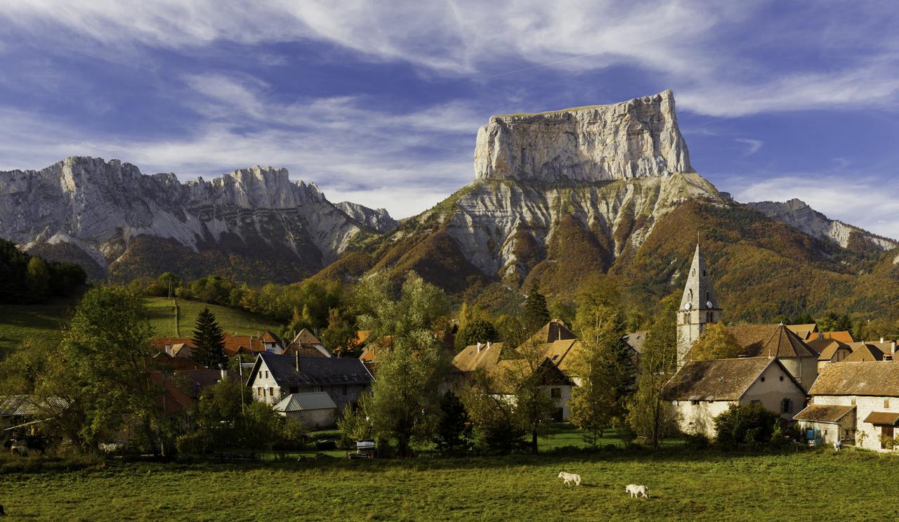
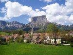
Stroll under the watchful gaze of giant Mont Aiguille
A hike through various hamlets that reflect the architectural riches of Trièves.
5 points of interest
RTM Back to the past
Compare with what you can see today! 150 years ago, the forest was sparse and confined to very steep slopes.
Crops dominated the meadows, the plots of land showed a more complex field pattern and hedges were rare. The slopes of Mont Aiguille were bare or studded with rough moorland that hardly covered the large gashes caused by erosion.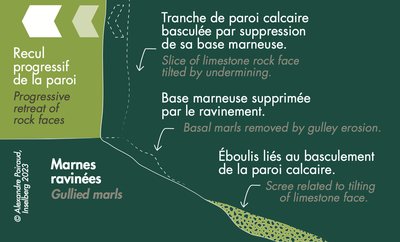
A. Poiraud Colossus with a foot of clay
The foot of Mont Aiguille is shaped from marl, a sedimentary rock that is prone to gully erosion and scouring. These numerous ravines are clearly visible on the south-eastern side. At the foot of the rock wall, the keen eye can make out huge blocks that come from the mighty limestone wall of Mont Aiguille. An entire portion of this wall collapsed one day due to the retreating ravines. This is how Mont Aiguille disappeared little by little following one collapse after another.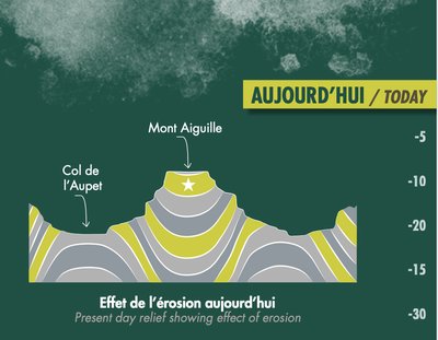
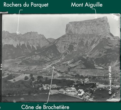
A. Poiraud The Mont Aiguille, tectonic ans erosion
Mont Aiguille is really an isolated piece of the Vercors massif situated within the Trièves mountains! This can be largely explained by the tectonic history.
The Vercors is the result of compression of the earth’s crust due to closure of an ocean basin during Alpine mountain building over almost 40 million years. As a result, the rocks were folded and fractured, leading to anticlines, synclines and faults.
While anticlines are more easily attacked by erosion, synclines remain resistant for longer.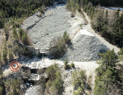
A. Poiraud Work to contain the torrent's energy
The torrent of Les Fraches runs in a debris flow channel which joins the Donnière stream.
The Mountain Land Restoration services carried out flood protection measures. The Allée Royale is a succession
of 23 small dams built between 1987 and 1992 to limit the scouring effect and break the energy of the torrent.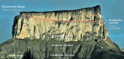
A. Poiraud An underwater channel?
Limestone is formed on the seabed through an accumulation of skeletons and shells of sea creatures. The limestone of Mont Aiguille was fashioned in a shallow sea in a tropical climate and close to the continent. This limestone is “stratified” like a millefeuille cake or a pile of plates, each sheet representing a period of sedimentation.
You can see this stratified limestone on the south-east face of Mont Aiguille in front of you. However, on the its upper section you can very clearly make out one level that cuts through the stratification at an angle. This is almost certainly an old underwater channel that created ravines in the sediment that was already there.
Once established, sedimentation was able to restart and plugged this channel.
Description
- From Chichilianne, head in the direction of Près des Oches followed by Le Châtel and Chevalanche.
- Carry on towards Pierre aux Corneilles and Les Crêtes. Now take the GTV on foot to Les Fontaines via Au Transformateur and Ruthière.
- Branch off to Richardière via the Pont de Donnière and continue until Fourchaux.
- You will begin the walk back via La Rimas, Les Frâches, Le Cros and Le Rapon to get to your starting point at Chichilianne.
- Departure : Chichilianne
- Arrival : Chichilianne
- Towns crossed : Chichilianne
Forecast
Altimetric profile
Sensitive areas
Golden eagle
- Impacted practices:
- , ,
- Sensitivity periods:
- JanFebMarAprMayJunJulAug
- Contact:
Recommandations
Use the purpose-built throughways to cross fences; shut gates and barriers behind you.
Keeping to the signposted paths means you'll respect private property.
Information desks
Le Village, 38930 Chichilianne
Transport
By Train :
Train station Clelles-Mens
The OùRA multimodal route planner provides information about all the connections between regional trains, urban transport and departmental bus lines: https://www.oura.com/
By Bus :
With Cars Région, take line T95 towards Mens / Monestier-de-Clermont, and get off at La Poste of Monestier-de-Clermont; at the secondary school (collège), take line MEN05 (only on weekdays) and descend at Chichilianne.
You can also reach the car park by hitchhike or carpooling.
Carpooling :
Offer your services or book your carpooling on the regional Mov'Ici platform.
Access and parking
From Monestier-de-Clermont, take the D1075 towards Clelles and then head for Chichilianne via the D7.
Parking :
Report a problem or an error
If you have found an error on this page or if you have noticed any problems during your hike, please report them to us here: