Archeotrail : the craftsmen of Prehistory
The first part of the hike takes place mainly in a pleasant forest environment, before reaching the shelter of the pass of Vassieux then the crest and the summit of the But Saint-Genix (1,643m). After enjoying the magnificent view, the return to the Museum of Prehistory is always along the edge before returning to the undergrowth.
5 points of interest
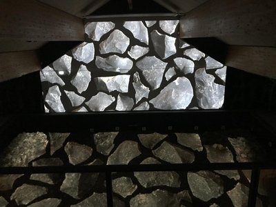
M. Rocheblave Flint Workshop
The southern part of the plateau of Vassieux is a flint-sized zone. The flint-sized workshop where the Museum of Prehistory was set up was discovered in 1970 by Dr. Michel Malenfant. It is then covered with a stone formed over the centuries by the plowing of the farmers. This is what protected and preserved it intact as abandoned by prehistoric men 4,500 years ago. After stripping and excavation, the workshop turns out to be a large blade production site (nearly 30 cm). It was exploited during three centuries, from 2700 to 2400 before J.C by Neolithic artisans-tailors. Tools of flint in Vassieux were found in the center of Germany and on the island of Ré. Farmers, occasional hunters, artisans and traders, these Neolithic men invented pluriactivity, which is still today a component of the economy of the mountain.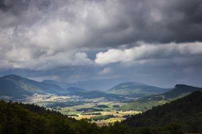
Vassieux-en-Vercors - S.M Booth The forests of Vassieux
The vast forests that you will cross are managed by the National Forestry Office. Although located on the territory of Vassieux-en-Vercors, which is responsible for the maintenance of forest roads (as these are communal roads, they are the public property of Vassieux), the forests themselves belong in reality to the town of Die and the town of Marignac-en-Diois. The benefits of the exploitation of wood therefore escape the commune of Vassieux.Before 1911, Vassieux was administratively attached to Die. The story goes that the municipality, unable to pay taxes, would have donated the land to pay its debts, which would explain the current situation.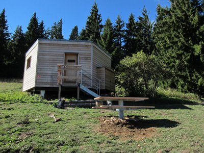
Abri du col de Vassieux - S. Fayollat Shelter of the Col de Vassieux
The shelter of the pass of Vassieux is an unguarded shelter built in 1976 and restored in 2014-2015 by the Regional Natural Park of Vercors.With a maximum capacity of 15 people, it is open all year and free of access. However, as with most shelter huts in the territory, certain rules must be respected if the service is to last for a long time (most of them are recalled to you inside the shelter).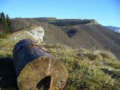
Col de Vassieux - M. Rocheblave The Col de Vassieux, ancestral crossing point
At about 500 meters from your position, you can see the pass of Vassieux. It has most probably been a place of exchange and passage from the Middle Palaeolithic, 50 000 years ago. What is certainly certain is that he later connected Die to Vassieux-en-Vercors. In 5 hours' walk, the cheeses, wool and charcoal produced at Vassieux were brought down, to climb painfully from the town of Die, wine, sugar, clothing and various tools. The opening of the various roads at the end of the 19th century reoriented exchanges towards the Vercors and Royans, which had become easier to access.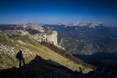
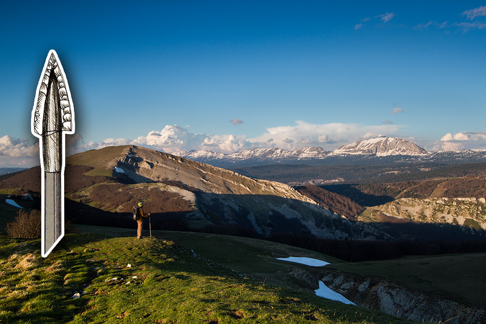
Paysage vu des alentours du But Saint-Genix, avec le Glandasse en fond - S. et M. Booth Panorama of the But Saint-Genix
From the But Saint-Genix to the Vassieux pass and from west to east, you can take a look at the plateaux of Font d'Urle and Ambel, where Mesolithic (9,500-5,500 BC) and Neolithic archaeological sites (5 500-2 500 BC) were uncovered.In the south, the Diois offers a mosaic of archaeological sites ranging from the Middle Palaeolithic (50,000 years) to the metal ages (800 BC). The city of Die, besides its Gallo-Roman past, also sheltered neolithic occupations, as evidenced by the discovery of a 4.12 m high menhir and various sites of habitats.In Marignac-en-Diois, at the foot of the Vercors, a collective burial in the cave of the Bronze Age was excavated. As in Vassieux, the flint of the Diois was exploited in particular at Boulc and Menglon.Finally, to the east, you can see the Hautes Plateaux du Vercors. They have been frequented since the Mesolithic, as evidenced by the site of Pre-Peyret.
Description
Departure from the Museum of Prehistory, direction Col de Vassieux 8. Take the road to Espeline 1, a strategic crossroads where the GR 93 and the Grandes Traversées du Vercors (GTV) intersect. From there, continue south and pass through Fontaine du Lauset 2 then Les Taillis 3. Leave the forest road to enter the forest and climb gradually to Coras 4, temporarily take the forest road again and reach the Fontaine du Plainet 5 and the Plainet crossroads 6. Take the itinerary on the right which leads to the shelter of the pass of Vassieux (unguarded hut open to the public) after about ten minutes. Still a few steps and the directional panel Entrecols 7 is in sight, with a breathtaking panorama over part of the Diois valley in particular. Here, clearly a pause is needed!
The hike continues along the ridge to reach the Col de la Chau 8, then Champ Rolland 9 before reaching the Saint-Genix Butte 1,643 meters 10, the highest point of this circuit And breathtaking views of the valley of Quint below. The path then leaves full north to reach, two kilometers away, the Pas Bouillanain 11 and continues its route towards the Crest of the Clots 12 passing by Pas de l'Ours.
At this junction, start the return to the Museum of Prehistory on the descent, taking the GR 93 on the right. Pass through Piarrou 13 and then at Espeline 14 take on the left, the last straight to the Museum .
Find more information in the guide Vercors, land of prehistory, available in bookshop and in the shop of the Park
- Departure : Museum of Prehistory, Vassieux-en-Vercors
- Arrival : Museum of Prehistory, Vassieux-en-Vercors
- Towns crossed : Vassieux-en-Vercors, Marignac-en-Diois, and Saint-Julien-en-Quint
Forecast
Altimetric profile
Recommandations
You are on summery areas, maybe you will meet protective dogs, often Patous. Always be sure to bypass the herds, while remaining calm while the dog identifies you, not caressing or threatening him. If you have a dog, hold it on a leash.
Use the passageways to cross the fences, close the gates and barriers.
Staying on marked trails also means respecting private property.
Information desks
Place Pietri, 26 420 La Chapelle-en-Vercors
Transport
By bus : line 05 : Valence-Vassieux-en-Vercors.
By hitchhikking : Find all the hitchiking spots on www.rezopouce.fr
By carpooling : Offer your services or book your carpooling on the regional Mov'Ici platform.
Access and parking
From Vassieux-en-Vercors, follow the D615 to the Museum of Prehistory.
Parking :
More information
Report a problem or an error
If you have found an error on this page or if you have noticed any problems during your hike, please report them to us here: