The Bec de l'Aigle et Bruyant gorges
Engins


The Bec de l'Aigle et Bruyant gorges
4h
11,6km
+0m
0m
Embed this item to access it offline
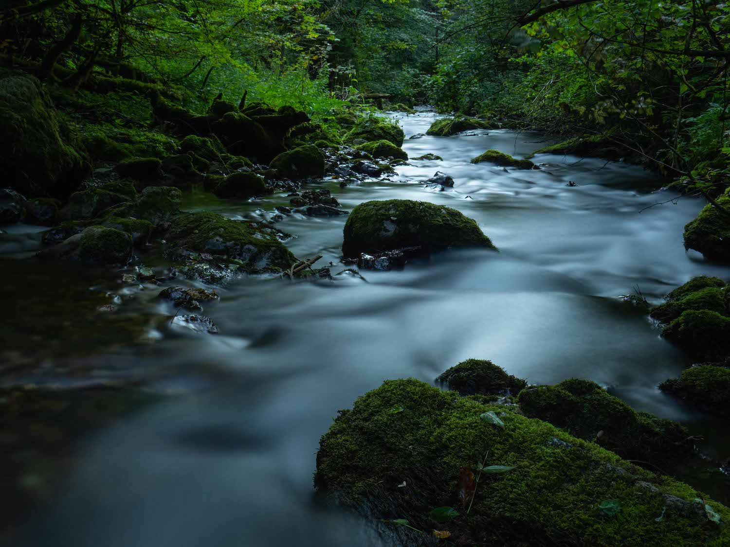
After a departure from the old tram station, the hike becomes progressively wilder, reaching the Gorges du Bruyant (a site classified since 1977), then a picturesque path along the river Furon.
1 point of interest
m_rocheblave Bec de l'Aigle
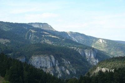
From Bec de l'Aigle, you can admire the panorama of the whole of your itinerary: the Furon gorges are in front of you, with the hamlet of Les Aigaux and the Plateau de la Molière in the background.
Description
Departure of the Tramway, in front of the Tourist Office, direction Bec de l'Aigle 6 passing by La Croix 1, Petits Geymonds 2, Pra Long 3, La Grange Verte 4 Combe 5. At the Bec de l'Aigle take the direction Le Haut Bruyant 8 passing by La Croix de Lichou 7.
From the HautBruyant you enter a gorge in the Gorges until the Bruyant 9 (alt 894 m). The return to Lans-en-Vercors is via a picturesque path, along the Furon, then via the Danes trail (Passage to avoid however in wet weather) and finally to the plateau of Val de Lans by La Combe. From there, the return to the village is carried out by the same way that on the way.
From the HautBruyant you enter a gorge in the Gorges until the Bruyant 9 (alt 894 m). The return to Lans-en-Vercors is via a picturesque path, along the Furon, then via the Danes trail (Passage to avoid however in wet weather) and finally to the plateau of Val de Lans by La Combe. From there, the return to the village is carried out by the same way that on the way.
- Departure : The Tramway, Tourist Office of Lans-en-Vercors
- Arrival : The Tramway, Tourist Office of Lans-en-Vercors
- Towns crossed : Engins, Lans-en-Vercors, and Saint-Nizier-du-Moucherotte
Forecast
Sensitive areas
Along your trek, you will go through sensitive areas related to the presence of a specific species or environment. In these areas, an appropriate behaviour allows to contribute to their preservation. For detailed information, specific forms are accessible for each area.
- Impacted practices:
- Sensitivity periods:
- AprMayJun
- Contact:
- https://www.parc-du-vercors.fr/
https://www.lansenvercors.com/
Recommandations
Be vigilant in rainy weather, between Le Bruyant and La Combe, slippery and delicate passages!
Use the passages provided to cross the fences, close the gates and barriers behind you.
Stay on the marked paths is also respect private property.
Use the passages provided to cross the fences, close the gates and barriers behind you.
Stay on the marked paths is also respect private property.
Information desks
246 avenue Léopold Fabre, 38250 Lans-en-Vercors
Place du Village, 38250 Saint-Nizier-du-Moucherotte
Transport
By train : Grenoble train station
The OùRA multimodal route planner provides information about all the connections between regional trains, urban transport and departmental bus lines : https://www.oura.com/
By bus : With Regional coaches T65 or T64 from Grenoble to Lans-en-Vercors.
By hitch hiking : You can get there / get back by hitching a lift with the Rezo Pouce network from Autrans-Méaudre, Lans-en-Vercors, Grenoble and Royans-Vercors (you can find all the stops in the Vercors on www.rezopouce.fr).
Carpooling :
Offer your services or book your carpooling on the regional Mov'Ici platform.
Access and parking
From Sassenage follow the D531 towards Lans-en-Vercors.
From Villard-de-Lans, follow the D531 towards Lans-en-Vercors.
From Villard-de-Lans, follow the D531 towards Lans-en-Vercors.
Parking :
Parking of the Tourist Office / Bus station
Report a problem or an error
If you have found an error on this page or if you have noticed any problems during your hike, please report them to us here: