Pionnier-Ambel
Bouvante

Pionnier-Ambel
5h
22,7km
+680m
-677m
Embed this item to access it offline
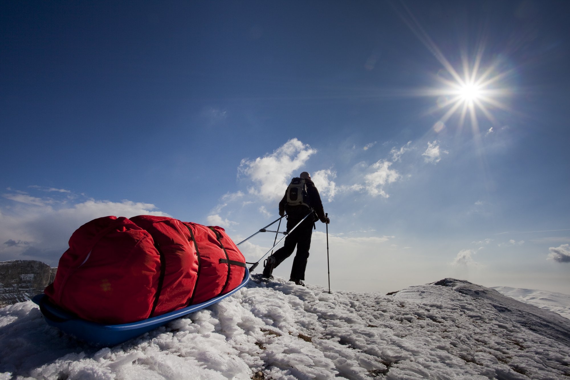
Crossing this area of the southern Vercors, you enter the recognized limit between the Northern Alps and the Southern Alps. During this excursion you will probably come closer to this invisible line ... You will first sink into deep forests of pectinated fir and beech.
The beauty of the vegetation will make forget the monotonous forest trail. Then, the immensities of the mountain pasture of Ambel will reward your efforts. The skier will appreciate the possibilities of gliding on this wild plateau. The punctuation of the refuges on the ground will allow peaceful halts ...
The beauty of the vegetation will make forget the monotonous forest trail. Then, the immensities of the mountain pasture of Ambel will reward your efforts. The skier will appreciate the possibilities of gliding on this wild plateau. The punctuation of the refuges on the ground will allow peaceful halts ...
2 points of interest
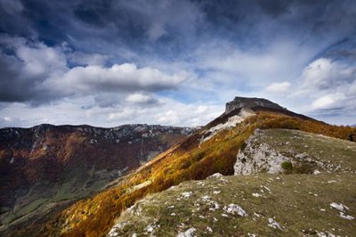
Ambel - S&M Booth The plateau d'Ambel
The Plateau d'Ambel is a "sensitive natural space" where flowers are forbidden. At the heart of a limestone fold of the Vercors, the Plateau d'Ambel consists of vast lawns and a mosaic of clearings and forests. Between the pre-Alps of the north and the south, the fauna and the flora are particularly rich. The summer of the cows and horses are in the summer.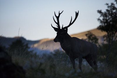
Cerf - S&M Booth The deer
The forest of Ambel is particularly appreciated by the Cerf. This large deer can weigh up to 250 kilos, comes to breed in the forest of Ambel. From mid-September to mid-October, this is the rutting period, so you can hear the stag's slab. However, this important period for the stag requires a certain tranquility, stay on the paths and be silent, respect the instructions of the information panels.
Description
- From the parking (1085 m) created by the closing of the road, follow the snowy road D199 towards the Col de la Bataille. The trail sits quietly in the forest of Lente. After 30 minutes of progression, leave on the right the forest road of the Pionnier (1185 m). Do not take the central path that runs to the Col de la Rama (0,7 km), in short, go straight ahead. At the next junction leave the D199 road and take the track on the left, at Carrefour de la Carrière (1310 m) (barrier).
- Continue towards Tubanet refuge (3.9 km). The south-facing orientation and the yellow and green markings allow easy tracking. Leave on the right the forest track of Malatra which joins the D199. Join a sign with regulations on the Ambel Plateau. The shelter of Tubanet is then distant of 1.6 km. Return to the forest of Ambel. Reach the pastures of Tubanet which are located on the plateau of Ambel (1337 m). The refuge of Tubanet is located at 0.2 km below. (1330 m - 2 hours).
- From the refuge 3 (1330 m), return to the pastures of Tubanet and descend into the Combe de l'Aubasse. Join the trails of the GR 93, go up the valley and enter the forest. After beautiful descents, join the Vernâtre (1198 m) located under the farm of Ambel. Pull right (full north) in the wide valley until the combe of Louvaterre (1165m). Continue to the Gardiol (refuge - memorial). From the refuge, take the D199 to reach the car park. From the refuge of Tubanet, it takes about 3 hours to reach the starting point of the hike. The route on the departmental road passes the skier to the clearing of Malatra (1280 m).
- Departure : Crossing of the Pionniers road -Col de la Portette
- Arrival : Crossing of the Pionniers road -Col de la Portette
- Towns crossed : Bouvante and Omblèze
Forecast
Altimetric profile
Sensitive areas
Along your trek, you will go through sensitive areas related to the presence of a specific species or environment. In these areas, an appropriate behaviour allows to contribute to their preservation. For detailed information, specific forms are accessible for each area.
Recommandations
There is no difficulty in tracking the forest tracks. On the plateau of Ambel and in the combes, the fog arrives quickly and to locate becomes difficult.
In bad weather, it is best to follow the markup in place.
The winter access to the plateau of Ambel is prohibited by the departmental road 199 (Col de la Bataille - Fontaine de Pis) and by the Roc de Touleau road (Col de la Bataille - Pas du Gouillat - GR93) Avalanches, falls of stones and slides - Departmental decree n ° 3 of 11/02/1999.
More information on Nordic Walking
Nordic walking is a respectful and responsible practice. Before you jump into the field, train yourself.
Information desks
13 Place de l'Eglise, 26190 Saint-Jean-en-Royans
Access and parking
From Grenoble, take the A49 towards Saint Marcellin (direction Valence). Join Saint Nazaire in Royans, Saint Jean de Royans and Bouvante. Continue towards Col du Pionnier. Go past the inn of the same name. Park one kilometer at the intersection of the Col de la Bataille road (closed in winter).
Parking :
Barrier of the road of the col de la Bataille
Accessibility
- Emergency number :
- 112
Report a problem or an error
If you have found an error on this page or if you have noticed any problems during your hike, please report them to us here: