Rousset pass - But de l'Aiglette
Chamaloc


Rousset pass - But de l'Aiglette
3h30
9,9km
+463m
-462m
Embed this item to access it offline
The But de l'Aiglette, from the Col de Rousset, is a more than seductive stage. Although short, this route offers a great diversity of landscapes. The ski hiker will appreciate, from the southern edge of the plateau of the Vercors, the view overlooking the marshy hills of the Diois which extend at its feet.
He will have, during this incursion, perhaps the chance to observe the Vulture Fauve reintroduced in 1996 in the Regional Natural Park of Vercors.
He will have, during this incursion, perhaps the chance to observe the Vulture Fauve reintroduced in 1996 in the Regional Natural Park of Vercors.
3 points of interest

Vtt sur le chemin de Chironne - PNRV Ancient Roman road
A superb mule track (ancient Roman road), carved in the middle of a cliff, allowed the convoys of mules and the flocks to climb from the Diois, to reach the Chironne meadow and then, via the eponymous pass, to Vercors. This development, which required many years of work and many years of work, shows the men's perseverance in providing access to the valuable resources of mountain pastures.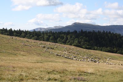
Alpage de Chironne - P.Mayade The Chironne mountain pasture
It is an enclave of the commune of Chamaloc located at the foot of the road of the pass of Rousset on the plateau of Vercors. Pastoral tradition of the south of France, the transhumance of the sheep is registered in the agricultural practices for more than 1000 years. Each commune of piedmont has always sought to have alpine pastures on the surrounding mountains. A pastoral grouping, allows several breeders of the villages below, associated with colleagues of Alpes de Haute Provence, to finance a shepherd and the equipment necessary to the sheep of a herd of sheep: access track, catchment of sources , Water reservoir and sheepfold. Attention, we are in a wolf zone. The herds are protected by Patou dogs. If you cross sheep, make a wide detour. Keep your dog on a leash!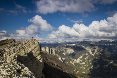
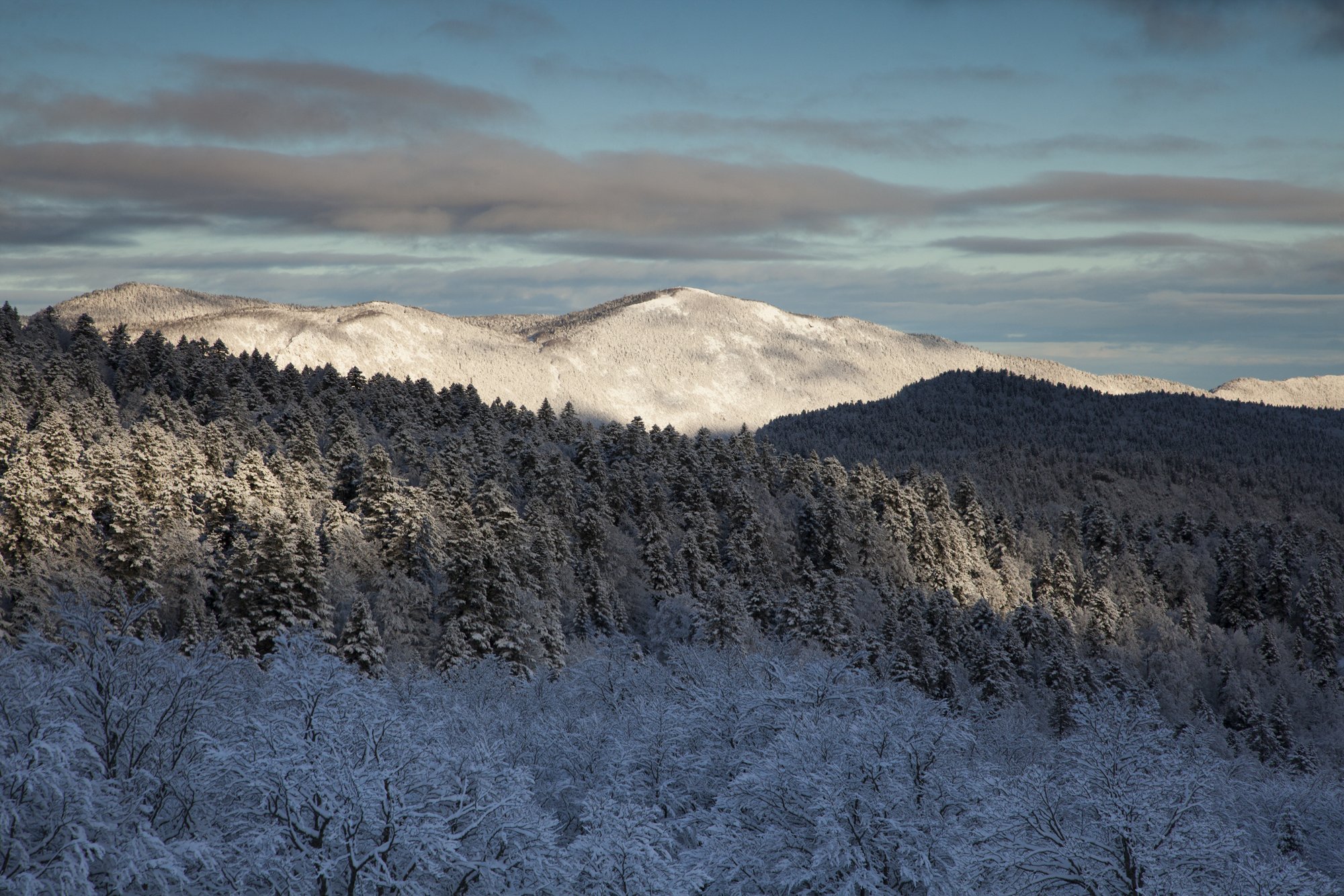
But de l'Aiglette - S.M Booth The But de l'Aiglette 1524m
The But de l'Aiglette with its 1524 m, is a promontory of the cliffs South of the Vercors. The 360 ° panorama is magnificent: from the Diois to the South to the plateau of Vercors in the North.
Description
From the tunnel carpark (1254m), take the old Roman road which overlooks the Diois, pass under the departure of the Via Ferrata, path in cornice carved in the rock. Then, go under a canopy to quickly reach a snowy valley. Shoot full North for Col de Chironne 1 (1416m). Climb south-west the slight slope leaving on the right the cross-country ski run that runs to Vassieux-en-Vercors. At point 1467m on the IGN map, join the southern edge of the plateau above the Rochers de Chironne. Follow the ridge that runs into the forest (south-west orientation). After about 1h30, reach the But de Aiglette 2 (1524m).
Return:
The return is identical to the itinerary of the outward journey.
Return:
The return is identical to the itinerary of the outward journey.
- Departure : Tunnel of the Col de Rousset
- Arrival : Tunnel of the Col de Rousset
- Towns crossed : Chamaloc and Vassieux-en-Vercors
Forecast
Altimetric profile
Sensitive areas
Along your trek, you will go through sensitive areas related to the presence of a specific species or environment. In these areas, an appropriate behaviour allows to contribute to their preservation. For detailed information, specific forms are accessible for each area.
Griffon vulture
- Impacted practices:
- , ,
- Sensitivity periods:
- JanFebMarAprMayJunJulAugDec
- Contact:
Recommandations
This itinerary is only to be undertaken on a safe basis. The route follows a ridge course with significant peaks. Before leaving, inquire about the level of snow, risk of cornices in edge of cliffs. The departure of the hike may lack snow.
More information on Nordic Walking
Nordic walking is a respectful and responsible practice. Before you jump into the field, train yourself.
More information on Nordic Walking
Nordic walking is a respectful and responsible practice. Before you jump into the field, train yourself.
Information desks
Place Pietri, 26 420 La Chapelle-en-Vercors
Transport
There is no regular public transport to reach Font d'Urle but from 26th of decembre to 9th of march, Drôme ski resorts organise a snow shuttle from Valence or Die to Bourg de Péage, Saint Laurent en Royans and Font d’Urle :
– every saturday and sunday (26th of decembre to 9th of march)
– Tuesdays and thursdays during school holiday (A zone)
Booking mandatory before 5pm for the next day on https://billetterie-fontdurle.intence.tech/shop?category_list=259
Out of the ski resort season, go to Vassieux-en-Vercors via bus line 05 (Vassieux - Valence) and reach Font d'Urle hitchhiking or by carpooling.
By hitch hiking : You can get there / get back by hitching a lift with the Rezo Pouce network from Autrans-Méaudre, Lans-en-Vercors, Grenoble and Royans-Vercors (you can find all the stops in the Vercors on www.rezopouce.fr).
Carpooling :
Offer your services or book your carpooling on the regional Mov'Ici platform.
Access and parking
From Grenoble, take the road to Sassenage, then the D531 towards Villard de Lans. Continue on the D531 towards Corrençon en Vercors. Continue towards the Gorges de la Bourne. Follow the D103 for St Martin en Vercors, then Tourtre. At Saint Agnan en Vercors continue on the D 518 until the station of the Col du Rousset. Continue towards Die on the D518 via the tunnel. Park, right, just out.
From Die, take the D 518, pass the village of Chamaloc and continue towards the Col du Rousset. Park on the left before the tunnel.
From Die, take the D 518, pass the village of Chamaloc and continue towards the Col du Rousset. Park on the left before the tunnel.
Parking :
Parking on the right after leaving the tunnel
Accessibility
- Emergency number :
- 112
Report a problem or an error
If you have found an error on this page or if you have noticed any problems during your hike, please report them to us here: