Postman's trail
Saint-Michel-les-Portes


Postman's trail
3h30
9,1km
+600m
-606m
Embed this item to access it offline
Heads up the southern slope through the forest. You will reach a typical Trièves hamlet. Come back down via the northern slope.
2 points of interest
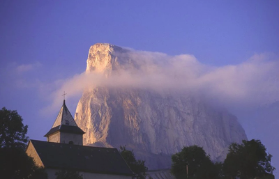
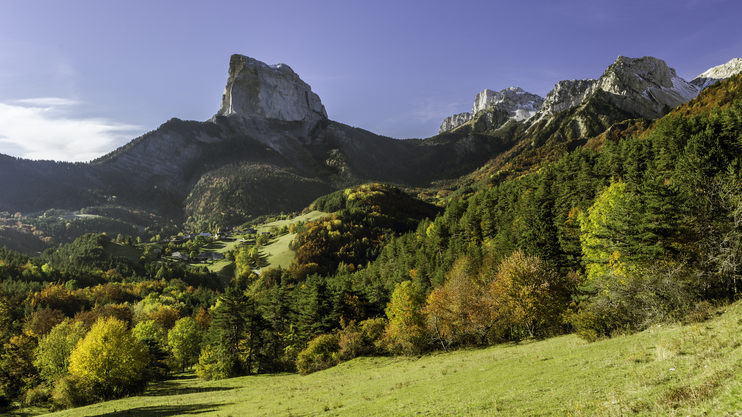
Le Mont Aiguille depuis La Bâtie - m_manche La Bâtie
The hamlet of La Bâtie between Mont Aiguille and Grand Veymont is lodged at an altitude of over 1,100 m. Only a handful of residents lived here all year round, grouped together around the chapel. Until 1858, when it was attached to Gresse-en-Vercors, La Bâtie was a parish in its own right. The hamlet was home to 22 families – around 100 inhabitants – in the 17th century. The chapel, which was rebuilt in the late 1800s, faces south-east. With its thick walls, half-buried porch and small openings, it is a typical example of a mountain chapel.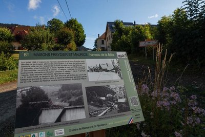
Z. Hudzikova Freydier and Maurice houses
On July 4, 1944, two houses in the hamlet owned by Madame Freydier were destroyed by the occupying forces following the ambush carried out the previous day by the Font Rousse Resistance at the Allimas pass. The first, here on the side of the road, had recently been repaired in 1938. It was clad in corrugated iron and consisted of four rooms, cellar and barn. The second, which was very close by, had a thatched roof and two rooms, a cellar, barn and stables with all the agricultural tools used at the time.
On July 21, 1944, the sheepfold belonging to Léon Maurice was burned down during the attack in the south-east of the Vercors as part of the general offensive by the 157th Reserve Division under the command of General Pflaum.
Description
- From Saint Michel de Portes take the trail above the village which snake between meadows in the direction of La Bâtie, via Blanchard and the Chauplane stream.
- From La Bâtie, head for Saint Michel des Portes via Chez Cotte and Les Pellas.
- At the Les Pellas intersection, head for la Lausière, then Pont de l'Eteiller. You follow the stream for 1km, past the "Moulin de Gaud" (water-mill), now renovated, and reach the road at Darreire. The village of Saint Michel de Portes is close by.
- Departure : Saint Michel les Portes
- Arrival : Saint Michel les Portes
- Towns crossed : Saint-Michel-les-Portes and Gresse-en-Vercors
Forecast
Altimetric profile
Recommandations
Please use the purpose-built gates and stiles to cross fences; shut gates and fasten behind you.
Keeping to the signposted paths means you'll respect private property.
Keeping to the signposted paths means you'll respect private property.
Information desks
Access and parking
From Grenoble take the motorway A51 to the Fau pass. Then follow departmental road 1075 and the D247 to Saint Michel les Portes.
From Lus la Croix Haute follow departmental road RD1075 to Michel les Portes.
From Lus la Croix Haute follow departmental road RD1075 to Michel les Portes.
Parking :
In the village
Report a problem or an error
If you have found an error on this page or if you have noticed any problems during your hike, please report them to us here: