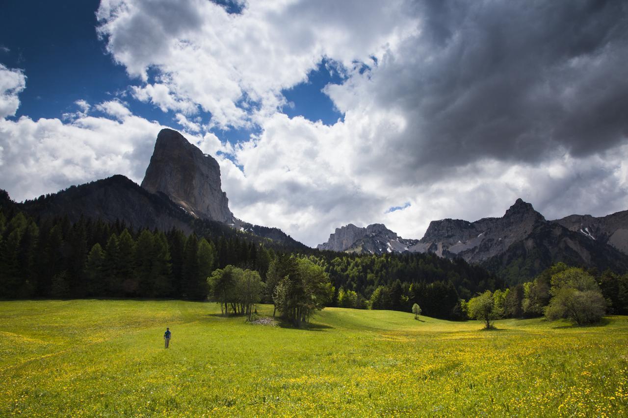
Between Mont Aiguille and Grand Veymont
A varied route that takes you to the foot of the Grand Veymont with superb views of famous Mont Aiguille.
4 points of interest
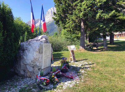
B. Brun-Cosme Stone of Remembrance
After the Allied landings on June 6, 1944, growing numbers of Resistance fighters climbed the south-eastern edge of the Vercors to join the Maquis who had gathered in the mountains, which was now a very attractive proposition for them. But few men were on hand to guard these high, narrow passages when the 157th Alpine Reserve Division launched a widespread attack on July 21, 1944. Under the command of General Pflaum, the aim of the Germans was to crush the Vercors Maquis. In spite of the courage and bravery they showed during the fighting, the watchmen were quickly overcome by an enemy with superior numbers and weapons. The order to disperse was received on July 23, leaving military victory to the Germans. Resistance fighters from inside the plateau were also cut down when they tried to exfiltrate through the passes. This stone, placed symbolically at the foot of the Pas de la Ville, serves as a reminder of them.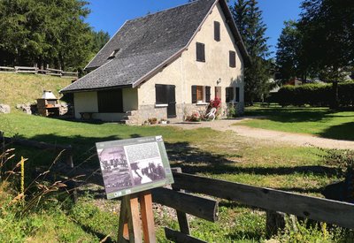
B. Brun-Cosme Maison Gaston Faure
A barn belonging to a farmer, Gaston Faure, once stood on this spot. Erected in the autumn of 1940 by the Scouts and Skiers Section of the 6th Battalion of Alpine Infantrymen, it was then used as a high mountain training centre for the unit. Large numbers of mountain infantrymen undertook their training here in the winter of 1940-1941. Alongside them were storied leaders who later joined the Resistance and took part in the battles of the Vercors: Chabal, Tanant, Gardent and Eysseric. German troops destroyed the house with explosives on July 4, 1944 in retaliation for the Resistance’s attack on their convoy the day before at the Allimas pass.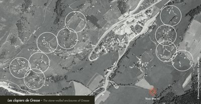
A. Poiraud The stone-walled enclosures of Gresse
In Gresse, stones and pebbles have been cleared from the land over many generations so the soil can be used for cultivation. The stones were removed by hand and piled up to form boundaries for the fields. This ancestral practice leaves a particular mark on the landscape and can be found in other regions with stony terrains, such as in the Massif Central or Scotland.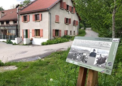
B. Brun-Cosme Uclaire
In the autumn of 1943, a handful of Resistance fighters set up here in the hamlet abandoned by the Scouts and Skiers Section of the 6th Battalion of Alpine Infantrymen. They spent the winter of 1943-1944 under the command of Louis Kalck (André), with Robert Adage serving as liaison officer. Their numbers rose in the spring of 1944. The camp consisted of 37 men in July, nearly all of whom came from the region, with Achille Demaret (Potin) in command. They left in haste on July 3, 1944 after being warned about the attack by the German convoy at the Allimas pass, before making their way to the Resistance in the Vercors. The next day, July 4, the Germans destroyed the site they had left behind, burning the hamlet to the ground.
Description
- From Champ de l'Herse, follow the track to the left of the little bridge in the direction of the Baraque du Veymont (an unmanned open forest shelter). Then head for Tiolache, Au Barri and La Bâtie.
- Carry on until you reach the Ruisseau de Chauplane stream and the Col de l'Allimas pass, where you can drink in the breathtaking view of Mont Aiguille.
- To get back to where you started your walk, carry on following the signs as you pass through Pas de Bru, Combe Rouge, Aux Fayolles, Côte Emblay and Girard. And now you are back at the Champ de l'Herse.
- Departure : Gresse-en-Vercors - From Champ de l'Herse
- Arrival : Gresse-en-Vercors - From Champ de l'Herse
- Towns crossed : Gresse-en-Vercors
Forecast
Altimetric profile
Recommandations
Be careful in winter : the route is impassable and is also very tricky in spring because of snowslides! (ask at the tourist offices before setting off).
Use the purpose-built throughways to cross fences; shut gates and barriers behind you.
Keeping to the signposted paths means you'll respect private property.
Information desks
43, route du Grand-Veymont, 38650 Gresse-en-Vercors
Transport
Access and parking
From Grenoble, take the A51 south to Monestier-de-Clermont before heading for Gresse-en-Vercors along the D8. Now walk to the far end of the ski resort car park to get to Champ de l'Herse.
Parking :
Report a problem or an error
If you have found an error on this page or if you have noticed any problems during your hike, please report them to us here: