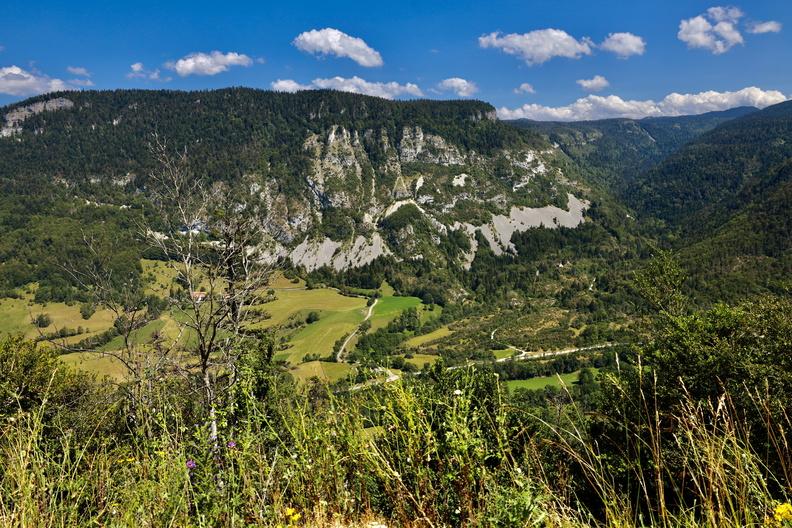
The Rancs de Charles
Saint-Agnan-en-Vercors
The Rancs de Charles
3h30
9,4km
+570m
-570m
Embed this item to access it offline
This beautiful hike from the hamlet of Rousset in the valley of the Vernaison is mainly forest, but still presents some technical passages in the scree.
2 points of interest
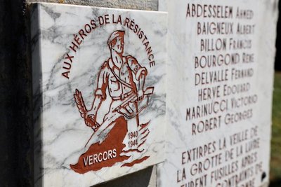
B. Claeyssen Stele of Rousset
At the Oules bridge, upstream of the hamlet of Rousset, height seriously injured people treated at the maquis refugee hospital in Luire were killed after being forced to dig their graves. The youngest, René Bourgond is 17 years old. He is a worker, originally from Romans.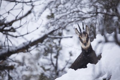
Chamois - S.M Booth
Description
Departure of the hamlet-village of Rousset (parking), direction the Rancs of Charles 4.
Take the road for some 300 meters to the crossroads of the Pont des Oules 1, continue on this one hundred meters before turning on the left to join a path that advances in laces in the middle of boxwood groves (Not missing in passing a small visit of the Chapel Saint-Alexis). At the Pont des Scies 2, the hike continues for a moment by a wide track before turning abruptly on the left to join the crossroads of the Château d'Eau 3.
From there, the trail becomes more "mountainous and steep" (caution in rainy weather) and progresses in laces in a scree before joining the forest road of Béguère at the crossroads Rancs de Charles (point of view). The rest of the route follows the direction of Rousset, the track gradually descends into the undergrowth to reach the crossroads of the Barrière de Béguère 5.
Go down to the Mémont 6, then always in the forest, continue until the road that crosses a second time to initiate the final slope leading to the Liottards 7.
The return to Rousset is then made by Le Reservoir 8 then the Bridge of the Oules.
- Departure : Hamlet of Rousset, Saint-Agnan-en-Vercors
- Arrival : Hamlet of Rousset, Saint-Agnan-en-Vercors
- Towns crossed : Saint-Agnan-en-Vercors
Forecast
Altimetric profile
Sensitive areas
Along your trek, you will go through sensitive areas related to the presence of a specific species or environment. In these areas, an appropriate behaviour allows to contribute to their preservation. For detailed information, specific forms are accessible for each area.
Golden eagle
- Impacted practices:
- , ,
- Sensitivity periods:
- JanFebMarAprMayJunJulAug
- Contact:
Recommandations
Watch out for rain in the scree crossings!
You may pass through pet parks along your hike. Thank you for closing the gates behind you and respect the tranquility of the herds.
You may pass through pet parks along your hike. Thank you for closing the gates behind you and respect the tranquility of the herds.
Information desks
Place Pietri, 26 420 La Chapelle-en-Vercors
Access and parking
From the Balme-de-Rencurel, take the D103 towards Saint-Julien-en-Vercors, then Saint-Agnan-en-Vercors, passing Saint-Martin-en-Vercors. After Saint-Agnan, continue until the village of Rousset by the D518.
From Die, follow the direction of Col de Rousset via the D518. After the Col continue towards Saint-Agnan-en-Vercors, until the village of Rousset.
From Die, follow the direction of Col de Rousset via the D518. After the Col continue towards Saint-Agnan-en-Vercors, until the village of Rousset.
Parking :
Parking hamlet of Rousset
Report a problem or an error
If you have found an error on this page or if you have noticed any problems during your hike, please report them to us here: