The Molière
Méaudre


The Molière
5h
17,7km
+785m
-785m
Embed this item to access it offline
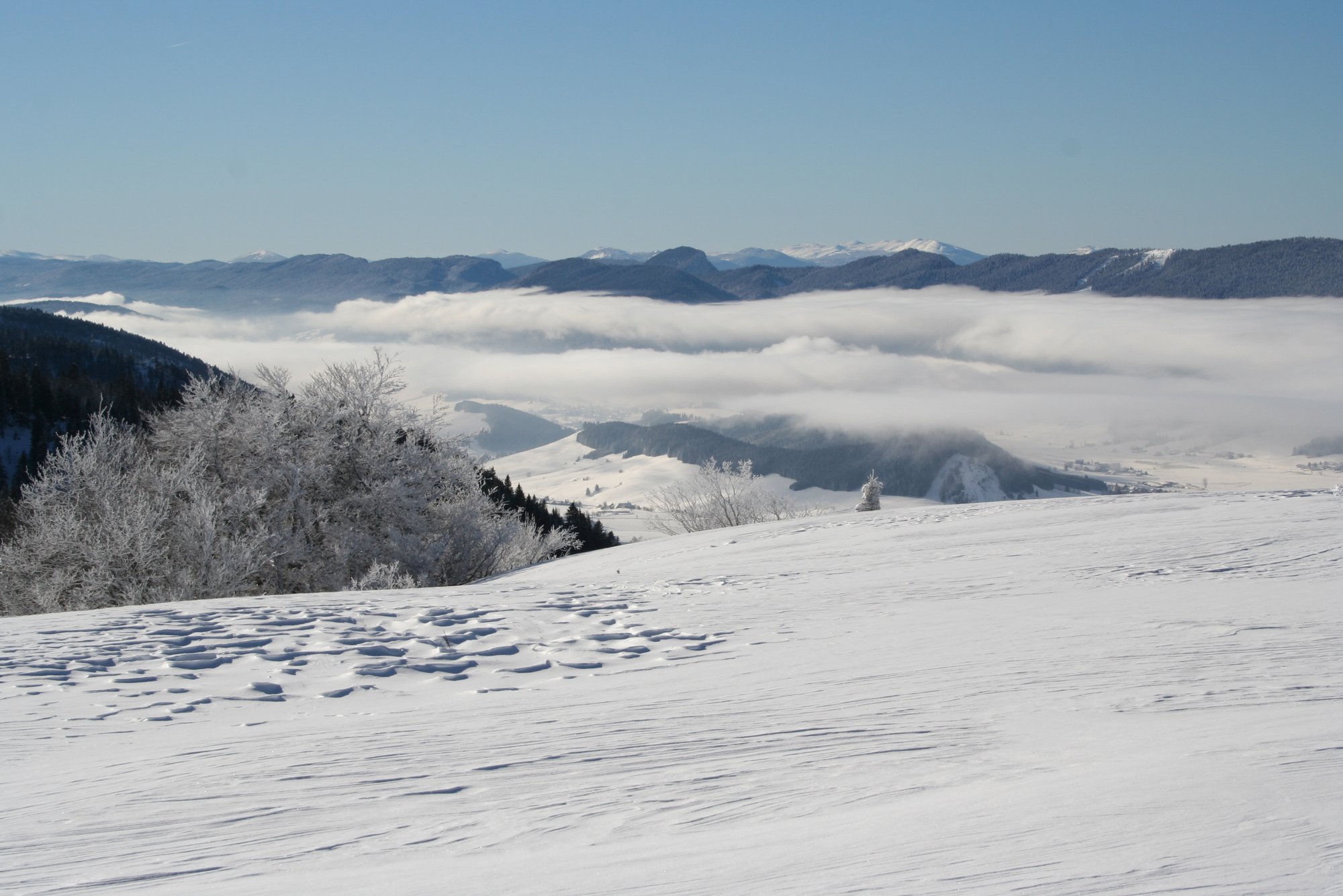
The proposed route is located in the so called "Quatre Montagnes" in the heart of the Vercors Regional Nature Park (PNRV). The panorama, from the crests of the Molière, is remarkable. On this itinerary, the skier evolves, initially, in the forest, then on the ridges overlooking the Val de Lans. Finally the ski hiker reaches the summit of Charande and the mountain pastures of the Molière. The view is magnificent on the Vercors north, the Grenoble region and the Alps!
1 point of interest
Belvédère de la Molière - S.M Booth Viewpoint of the Molière
The viewpoint of the Molière offers one of the most beautiful panoramas of the Vercors. A large part of the Alps is offered to you as far as Mont Blanc, passing by the Chartreuse, Belledonne or Oisans.
Description
- From Col de la Croix Perrin (1218 m), turn right onto the signposted road (yellow and green) for the Molière (8.3 km). Follow this forest track that runs into combe de Rui and reaches the ridges overlooking Lans-en-Vercors village. Leave the path that runs south on the Croix de Jaume and go up along the ridge. Join a flat in the forest of Guiney at altitude 1529 m (1 hour). Reach the sign indicating "Les Trois Communes" (1636 m). Follow the signs for 1.8 km and follow the direction of Pas de Bellecombe (1636 m).
- Follow (La Molière - 3.1 km) on the ridges overlooking the mountain pastures. Pass le relais, the Pas de l'Ours (1649 m) and reach the summit of Charande (1709 m). Continue north towards the Pas de la Tracollet (1648 m) and then to the alpine meadows and the orientation table of the Molière (1632 m - 3 hours.) Magnificent view of the region and the surrounding mountains Mont Blanc.
Return:
The return is identical to the itinerary of the outward journey. At the sign of Les Trois communes, shoot right (west) and join a track that runs south. Follow it to the end (turning point for the forestry machines) and, before this elbow, spin in the forest, due west (yellow and green markings). Go down and join the Barthélemy forest trail. Turn left (south) to the Croix Perrin pass.
For those wishing to make a loop, you just have to take the forest road of the Molière to the shelter of the Feneys (1522 m). At the intersection (before the refuge), leave the road that goes to the right for the snow stage of the Sure (Autrans). Pull left onto the forest road Barthélemy which goes down on the Col de la Croix Perrin. (Descent in 1 hour).
- Departure : Col de la Croix Perrin , Lans en Vercors
- Arrival : Col de la Croix Perrin , Lans en Vercors
- Towns crossed : Méaudre, Lans-en-Vercors, Autrans, and Engins
Forecast
Altimetric profile
Sensitive areas
Along your trek, you will go through sensitive areas related to the presence of a specific species or environment. In these areas, an appropriate behaviour allows to contribute to their preservation. For detailed information, specific forms are accessible for each area.
- Impacted practices:
- , , , ,
- Sensitivity periods:
- JanFebMarAprMayJunJulAugSepOctNovDec
- Contact:
- Nathalie LECRIVAIN Chargée de mission ENS Molière-Sornin
06.84.21.33.56
Floria CUISSON - Animatrice Natura 2000 floria.cuisson@pnr-vercors.fr
Recommandations
Itinerary with no difficulty in good weather. During snow or fog, the orientation on the ridges is very delicate. This course is well attended by snowshoe walkers.
More information on Nordic Walking
Nordic walking is a respectful and responsible practice. Before you jump into the field, train yourself.
More information on Nordic Walking
Nordic walking is a respectful and responsible practice. Before you jump into the field, train yourself.
Herd protection dogs
In the mountain pastures, the guard dogs are there to protect the herds from predators.
When I hike, I adapt my behaviour by going around the herd and pausing so that the dog can identify me.
Click here to see the video : c'est quoi au juste un chien de protection ?
Information desks
49 route du Vercors, 38880 Autrans-Méaudre-en Vercors
246 avenue Léopold Fabre, 38250 Lans-en-Vercors
Transport
By bus : With regional coaches T65 or T64 for Lans-en-Vercors and then on line T66 to Autrans.
Please note that line T66 does not go further than Autrans. There is the option of finishing the walk at the car park by hitchhiking or carpooling.
By hitch hiking : You can get there / get back by hitching a lift with the Rezo Pouce network from Autrans-Méaudre, Lans-en-Vercors, Grenoble and Royans-Vercors (you can find all the stops in the Vercors on www.rezopouce.fr).
Carpooling :
Offer your services or book your carpooling on the regional Mov'Ici platform.
Access and parking
From Grenoble, take the road D531 (Route de Villard-de-Lans). At the roundabout of Lans-en-Vercors, turn right onto the D106 (Route de la Croix Perrin) which runs towards Autrans. Reach the pass (1218 m). Park next to the hostel.
Parking :
Parking at Col de la Croix Perrin
Accessibility
- Emergency number :
- 112
Report a problem or an error
If you have found an error on this page or if you have noticed any problems during your hike, please report them to us here: