Nordic circuit of Font d'Urle plateau
Bouvante
Nordic circuit of Font d'Urle plateau
2h30
8,5km
+448m
-452m
Embed this item to access it offline
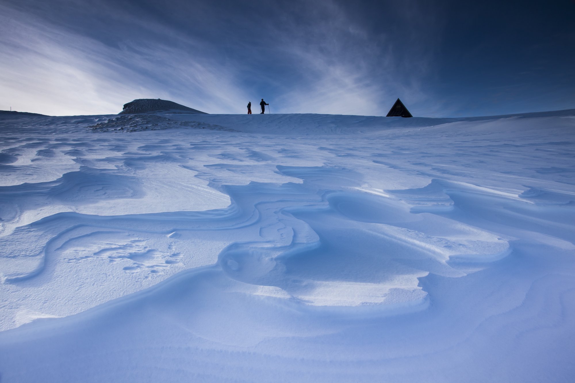
Spectacular itinerary in fine weather. A first part in edge of cliffs with impregnable view on the Diois and a second all in hollow and bumps, vallons and dollines on a semi desert plateau.
This is the real Nordic hike !!!
The Font d'Urle plateau is also a recognized spot of Kite surfing
This is the real Nordic hike !!!
The Font d'Urle plateau is also a recognized spot of Kite surfing
1 point of interest
Font d'Urle - S&M Booth Plateau of Font d'Urle
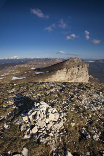
Property for a small part of the commune of Vassieux en Vercors, for the most part the department of Drôme since 1954, the departmental domain of Font d'Urle is a sensitive natural space. Its vocation is the protection of nature and the reception of the public. Some rules of common sense make it possible to protect this space as well as to cohabit in good understanding with the shepherds and their flocks. Picking flowers that are particularly spectacular in May and June is prohibited. Dogs, even on a leash, are prohibited during the summer season (May to October). In the middle of the mountain pastures, there are herds of horses in semi-freedom. In this vast steppe of altitude, stretch of grass and rocks "with for all border the sky" (Joseph Kessel), one would think oneself in Mongolia.
Description
- From the carpark, a sign indicates "Porte d'Urle" (900 meters) towards the south. It is reached in 15 minutes. Continue along the ridges for about 200 meters. Slightly bend to the left without going down onto the tray. The direction to follow is south-east always keeping to its right the edge of the plateau.
Often the wind makes the snowfall deficit.
The summit of Puy de la Gagère is the highest peak of the plateau. Turn left on a small valley below the ridges of the Gagères. Continue towards the south. Climb for 30 minutes and reach the summit of Puy de la Gagère (1651 meters).
It takes about 1:40. - The return can be done by the journey of the way.
Here we propose a loop route.
Descend from the summit following the crests of the Gagères. Go down slightly under the crests. Reach the Pot de la Croix. Pull on the left (west) following the edge of the plateau and the forest. After a few short descents, you reach the D76B road that follows 300 meters towards the station of Fond D'Urle.
On skiing, the return, on this hilly itinerary, takes about 50 minutes.
- Departure : Font d'Urle
- Arrival : Font d'Urle
- Towns crossed : Bouvante, Saint-Julien-en-Quint, and Vassieux-en-Vercors
Forecast
Altimetric profile
Recommandations
In good weather, this route does not involve any difficulty. In bad weather, it is better to choose another Nordic ski tour itinerary. The plateau is bordered by cliffs and cliffs. It is also riddled with holes, scialets, and glaciers.
More information on Nordic Walking
Nordic walking is a respectful and responsible practice. Before you jump into the field, train yourself.
More information on Nordic Walking
Nordic walking is a respectful and responsible practice. Before you jump into the field, train yourself.
Information desks
13 Place de l'Eglise, 26190 Saint-Jean-en-Royans
Transport
There is no regular public transport to reach Font d'Urle but from 26th of decembre to 9th of march, Drôme ski resorts organise a snow shuttle from Valence to Bourg de Péage, Saint Laurent en Royans and Font d’Urle :
– every saturday and sunday (26th of decembre to 9th of march)
– Tuesdays and thursdays during school holiday (A zone)
Booking mandatory before 5pm for the next day on https://billetterie-fontdurle.intence.tech/shop?category_list=259
Out of the ski resort season, go to Vassieux-en-Vercors via bus line 05 (Vassieux - Valence) and reach Font d'Urle hitchhiking or by carpooling.
By hitch hiking : You can get there / get back by hitching a lift with the Rezo Pouce network from Autrans-Méaudre, Lans-en-Vercors, Grenoble and Royans-Vercors (you can find all the stops in the Vercors on www.rezopouce.fr).
Carpooling :
Offer your services or book your carpooling on the regional Mov'Ici platform.
Access and parking
From Grenoble, take the road to Villard de Lans, continue in the direction of La Chapelle en Vercors. From the village follow the D178 towards Vassieux en Vercors. Before the village take the D76 which quickly reaches the Col de la Chau (Memorial of the Resistance). Before Chaud Clapier, turn left for the station of Fond D'Urle.
Park at the entrance of the resort.
From Romans or Valence:
Take the direction of St Nazaire in Royans, then St Jean de Royans, the Col de la Machine, the village of Lente, continue until Chaud Clapier, then the station of Font d'Urle
Park at the entrance of the resort.
From Romans or Valence:
Take the direction of St Nazaire in Royans, then St Jean de Royans, the Col de la Machine, the village of Lente, continue until Chaud Clapier, then the station of Font d'Urle
Parking :
Parking of the Porte d'Urle
Accessibility
- Emergency number :
- 112
Report a problem or an error
If you have found an error on this page or if you have noticed any problems during your hike, please report them to us here: