The Tour des Coulmes (nordic)
Rencurel


The Tour des Coulmes (nordic)
4h
9,8km
+502m
-502m
Embed this item to access it offline
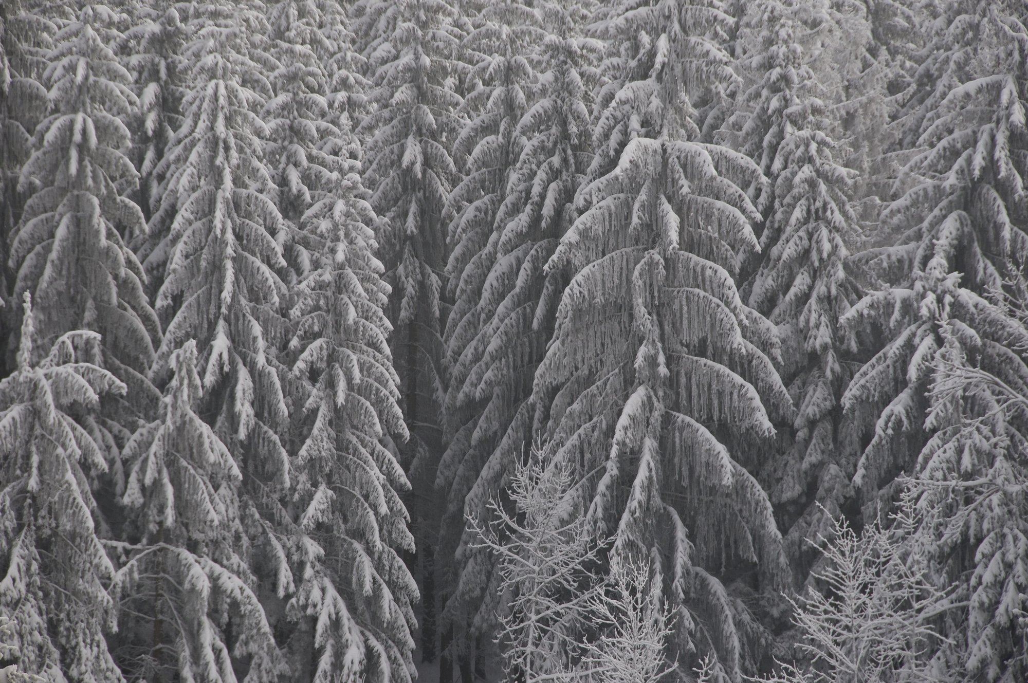
Les Coulmes is a part of the Vercors situated between the valley of the Isère, the gorges of the Bourne and the valley of Rencurel. The Coulmes forest estate is a fabulous Nordic hiking trail.
The skier explores a wild territory combining nature and culture. The site of the Goulandière is a very beautiful illustration; Magnificently located, it allows to enrich itself by discovering the heritage of the forest of Coulmes.
The skier explores a wild territory combining nature and culture. The site of the Goulandière is a very beautiful illustration; Magnificently located, it allows to enrich itself by discovering the heritage of the forest of Coulmes.
2 points of interest
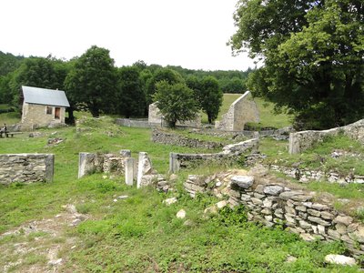
Les ruines du hameau de la Goulandière - OTSI Pont-en-Royans The Goulandière
The ruins of Goulandière tell the story of men who came to cultivate the land in this hamlet lost in the heart of the forest of Coulmes, without any water, as a challenge to nature. The houses are built on the rock, not to reduce the fields gained on the forest. The recent rehabilitation of the hamlet makes it possible to imagine this rude existence. Theme circuits invite you to discover the lifestyles of the Middle Ages.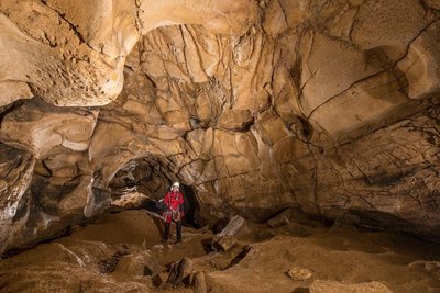
L'ntérieur de la grotte de Prélétang - S. Caillault Cave of Preletang
The cave of Preletang is the witness of human and animal occupations dating back several tens of thousands of years. Indeed, it has been the den of cave bears, species now disappeared, as evidenced by the rock made smooth by their repeated friction against the walls of the cave ("bear polis"). And the collapse of part of the porch sealed the traces of the Neanderthals who had stayed there 46,000 years ago.More than 300 flint tools were discovered on the site. They are made up of scrapers, spearheads, and waist chips. Most of the tools were not made locally but brought by the Neanderthals who were sheltering under the porch of the cave during hunting expeditions. The remains of wildlife brought to light consist of stag, deer, wild boar, marmot and ibex.Thus, thanks to this exceptional site, it is known that Neanderthals traveled the plateau of Vercors before the last glaciation. These men, our distant cousins, knew perfectly where to shelter, hunt and collect flint. It will be necessary to wait until the end of the last ice age (the Würm) so that the man, this time modern, ventures again on the massif.
Description
Le Chargeoir (1046 m) is located on the forest road of Pra l'Etang between the hamlet of Les Ailes and the place called Les Antis. From the Chargeoir, go up to Les Antis 1 (1100 m - ruins) turn left and then follow the GR 9 signs that lead to the ancient village of Les Antis. Continue to reach the unguarded shelter of Goulandière 2 (1065 m) which is reached in less than an hour.
From the Goulandière refuge, continue along the GR 9, leaving on the right the path that runs along the Siva. After a hundred meters, leave on the left the GR of country that joins Presles. Continue north towards Beauregard 3 (1255 m) then Pra l'Etang 4 (1245 m). Reach the refuge of the Serre du Sâtre 5 (1354 m) located on the route of the GR 9.
From the refuge of the Serre du Sâtre, take the cross-country ski trails for a hundred meters. Then join Les Gelinottes 6 (1340 m). Leave the traced tracks and follow the markings of the GR to the Chargeoir. From the refuge to the Chargeoir, count about 30 minutes of descent.
- Departure : Carrefour Le Chargeoir
- Arrival : Carrefour Le Chargeoir
- Towns crossed : Rencurel and Presles
Forecast
Altimetric profile
Recommandations
There is no difficulty with this route. Depending on the quality of the snow, the descent from the refuge of the Serre du Sâtre to the Chargeoir is delicate (a few fast passes in the forest).
More information on Nordic Walking
Nordic walking is a respectful and responsible practice. Before you jump into the field, train yourself.
More information on Nordic Walking
Nordic walking is a respectful and responsible practice. Before you jump into the field, train yourself.
Information desks
48 Grande Rue, 38680 Pont-en-Royans
Transport
There is no public transport to reach the start. The nearest village is Pont-en-Royans.
Access and parking
From Villard de Lans, take the Jarrands road (D 531). Continue on the road that follows the defile of the Bourne gorges. Join Rencurel. At the exit of the village, take the road on the left which runs towards the hamlet of Glénats and then that of the Wings. Park at the "Chargeoir" (road terminus in winter).
From Pont en Royans, take the gorges of the Bourne towards Villard de Lans, in the hamlet of Balme de Rencurel, turn left to join Rencurel (see above).
From Grenoble you can also take the D35 called Route des Ecouges, continue past the Col de Romeyrer, until the entrance of Rencurel. Take at the entrance of the village the road on the right which leads towards the hamlet of Glénats and then that of Les Ailes. Park at the "Chargeoir" (road terminus in winter).
Parking :
Place name Le Chargeoir
Accessibility
- Emergency number :
- 112
Report a problem or an error
If you have found an error on this page or if you have noticed any problems during your hike, please report them to us here: