East-West crossing of the Vercors on the GR®93 - Stage 3
Omblèze


3. East-West crossing of the Vercors on the GR®93 - Stage 3
7h
19,4km
+899m
-759m
Embed this item to access it offline
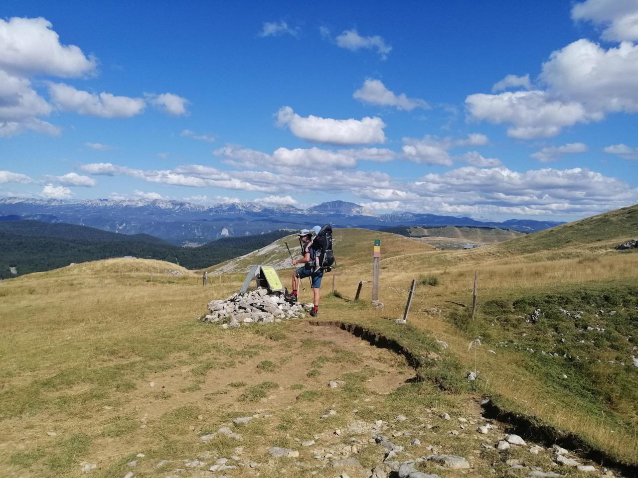
Soak up the mountain pastures of the Vercors in the Drôme.
4 points of interest
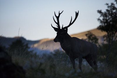
Cerf - S&M Booth The deer
The forest of Ambel is particularly appreciated by the Cerf. This large deer can weigh up to 250 kilos, comes to breed in the forest of Ambel. From mid-September to mid-October, this is the rutting period, so you can hear the stag's slab. However, this important period for the stag requires a certain tranquility, stay on the paths and be silent, respect the instructions of the information panels.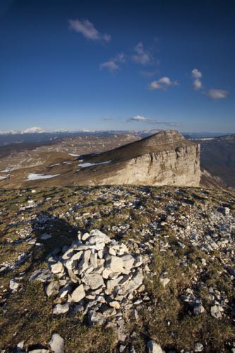
Font d'Urle - S&M Booth Plateau of Font d'Urle
Property for a small part of the commune of Vassieux en Vercors, for the most part the department of Drôme since 1954, the departmental domain of Font d'Urle is a sensitive natural space. Its vocation is the protection of nature and the reception of the public. Some rules of common sense make it possible to protect this space as well as to cohabit in good understanding with the shepherds and their flocks. Picking flowers that are particularly spectacular in May and June is prohibited. Dogs, even on a leash, are prohibited during the summer season (May to October). In the middle of the mountain pastures, there are herds of horses in semi-freedom. In this vast steppe of altitude, stretch of grass and rocks "with for all border the sky" (Joseph Kessel), one would think oneself in Mongolia.
Vassieux-en-Vercors - S.M Booth The forests of Vassieux
The vast forests that you will cross are managed by the National Forestry Office. Although located on the territory of Vassieux-en-Vercors, which is responsible for the maintenance of forest roads (as these are communal roads, they are the public property of Vassieux), the forests themselves belong in reality to the town of Die and the town of Marignac-en-Diois. The benefits of the exploitation of wood therefore escape the commune of Vassieux.Before 1911, Vassieux was administratively attached to Die. The story goes that the municipality, unable to pay taxes, would have donated the land to pay its debts, which would explain the current situation.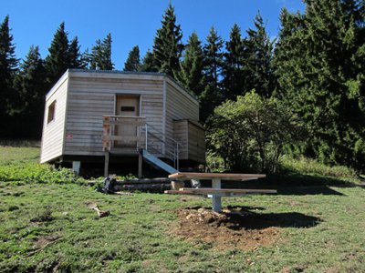
Abri du col de Vassieux - S. Fayollat Shelter of the Col de Vassieux
The shelter of the pass of Vassieux is an unguarded shelter built in 1976 and restored in 2014-2015 by the Regional Natural Park of Vercors.With a maximum capacity of 15 people, it is open all year and free of access. However, as with most shelter huts in the territory, certain rules must be respected if the service is to last for a long time (most of them are recalled to you inside the shelter).
Description
- From the Ambel refuge, head towards Font d'Urle via Verâtre, Tubanet refuge, Pâturage de Tubanet, Pierre de l'Ours, Pas de la Ferrière, Pas de l'infernet and Font d'Urle. Continue in the direction of Pot de la Croix and Col de Font-Payanne.
- At this crossroads, you can head to Vassieux-en-Vercors for a stopover (off the GR®93 approx. 4.5 km i.e. a stretch of some 18.5 km) or make for the refuge at Col de Vassieux via Piarrou, Espeline, Fontaine du Lauset, Les Taillis, Coras, Plainet and Entrecols.
- Departure : Ambel refuge
- Arrival : Vassieux-en-Vercors or Vassieux pass (Col de Vassieux)
- Towns crossed : Omblèze, Saint-Julien-en-Quint, Bouvante, Vassieux-en-Vercors, and Marignac-en-Diois
Forecast
Altimetric profile
Sensitive areas
Along your trek, you will go through sensitive areas related to the presence of a specific species or environment. In these areas, an appropriate behaviour allows to contribute to their preservation. For detailed information, specific forms are accessible for each area.
Griffon vulture
- Impacted practices:
- , ,
- Sensitivity periods:
- JanFebMarAprMayJunJulAugDec
- Contact:
- nicolas.renous@pnr-vercors.fr
Recommandations
Use the installed passages to cross fences, close gates and barriers.
Stay on the marked trails and respect private property.
The trails can be slippery in rainy conditions!
Do not cross hay meadows or cultivated fields.
Stay alert in spring: snowfields can last late into the season! (Check with the tourist office before setting out).
Important: when the weather is hot in summer, make sure you take ample water with you as well as adequate sun protection, including sunscreen, a hat or other essentials.
Parts of the route are at high altitude and may be covered in snow in winter. These sections may be impassable depending on your mode of transport.
Herd protection dogs
In the mountain pastures, the guard dogs are there to protect the herds from predators.
When I hike, I adapt my behaviour by going around the herd and pausing so that the dog can identify me.
Click here to see the video : c'est quoi au juste un chien de protection ?
Information desks
Place Pietri, 26 420 La Chapelle-en-Vercors
Access and parking
From Saint-Jean-en-Royans, follow the D76 towards the Col de l'Écharasson. Continue to the Col de la Machine (Machine pass). Then walk to the Ambel farm refuge.
Parking :
Col de la Bataille (Bataille pass)
Report a problem or an error
If you have found an error on this page or if you have noticed any problems during your hike, please report them to us here: