East-West crossing of the Vercors on the GR®93 - Stage 1
1. East-West crossing of the Vercors on the GR®93 - Stage 1
7h
20,8km
+525m
-134m
Embed this item to access it offline
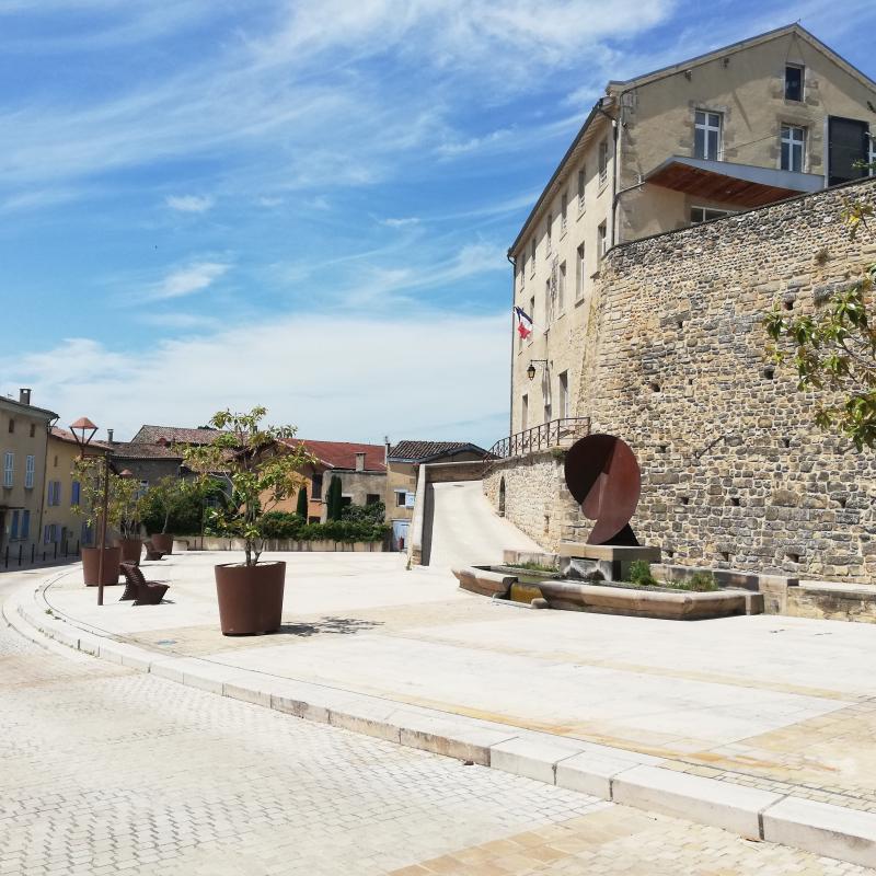
Urban environment before entering the Vercors Regional Natural Park.
Description
- Exit Valence TGV station via the Porte Alpes. Cross the small park and, when you reach the road, continue straight onto Cours d'Emile-du-Château. After 500 meters, leave the road on your left and take the path opposite to exit Parc de Rovaltin. At the housing estate, turn left onto Chemin de Maison-Blanche before taking the second street on the right onto Chemin des Abricotiers, which heads under the ring road (be careful here). At the crossroads, turn left and then take the first right along Chemin de Couchet. The housing estates slowly give way to farmland. Continue straight ahead on the track between the orchards. Head straight along the Chemin de Tournus for 1 km. Turn right at the hairpin bend onto Rue des Barrys. Take a left between the houses on Chemin de Coulet. Just before Pont sur la Barberolle, climb up to the left along the dike. The path follows the Barberolle, crossing roads four times until it reaches the entrance to the village of Alixan.
- Cross the D538 and pick up the route de Saint-Didier a few meters further on. Take a right until you get to the sports fields. Now turn left onto the path that heads north. Turn right and follow Chemin du Battoir.
At the crossroads, turn right and, at the first intersection, head left onto route des Massouillards in the direction of ferme des Marais (accommodation available here). After 900 meters, head left along route des Chamouillets. At the crossroads, continue straight ahead along the path. After a few meters, follow the trail into the woods, leaving the path to your right. Turn onto the track to the right towards Thomé. At Tâches, the GR®93 follows the same route as the Poilus trail. Cross the village of Saint-Didier. - Follow the yellow markers as you continue towards Charpey. As you leave the village, pass in front of the school. At the bridge, leave the main road and take the Chemin des Bonneries on your left. Cross the Guimaud by the walkway under the D115 and look for a trail running alongside the river. The route goes across a road before reaching the wastewater treatment plant. At the road, turn right onto Chemin des Robins and go up to the centre of the village of Charpey.
- Take the Grande-Rue on your left, then immediately to the right head along rue des Fosses towards the church. Go down to the left along the Montée de Bayard trail. Cross the footbridge over the Guimaud. The grassy trail now rises between two fields. At the cross, turn right onto the D119 before taking another right onto Chemin des Clos. At the road, turn right for 200 meters. After the bridge, head left into the woods. The path, which now becomes a trail, climbs up until it emerges from the woods. Follow the fence until you reach the road, then turn right. Walk across the hamlet of Bériches.
- Now head left in the direction of Toutes Aures. At the top of the climb, take the road on the right and head towards Col de Toutes Aures. Go back down in the direction of Peyrus. Cross the pont du Béal de Cors before taking the left in the hairpin bend onto Chemin des Carrats. When you get to the agricultural shed, follow the track on the right, then take the trail and keep to the right. Cross the road and go down Montée du Pont to get to Peyrus.
- Departure : Valence TGV train station - Alixan
- Arrival : Peyrus
Altimetric profile
Recommandations
Use the installed passages to cross fences, close gates and barriers.
Stay on the marked trails and respect private property.
The trails can be slippery in rainy conditions!
Do not cross hay meadows or cultivated fields.
Important: when the weather is hot in summer, make sure you take ample water with you as well as adequate sun protection, including sunscreen, a hat or other essentials.
Parts of the route are at high altitude and may be covered in snow in winter. These sections may be impassable depending on your mode of transport.
Before setting off, you can check your itinerary on the website of the Drôme branch of the French hiking federation : https://drome.ffrandonnee.fr/html/6277/modifications-d-itineraires or contact them on +336 59 03 48 30 or +336 58 01 59 75.
Information desks
Place du Général de Gaulle, 26400 Crest
48 Grande Rue, 38680 Pont-en-Royans
Transport
By train :
Valence TGV station
Lus-la-Croix-Haute SNCF station
The OùRA multimodal itinerary planner gives access to all the correspondences between regional trains, urban transport and departmental bus routes:
https://www.oura.com/
By bus: With regional coaches line n°31 Grenoble-Marseille which passes through Lus-la-Croix-Haute
Transport on request :
RESERVATION / CANCELLATION: +334 8000 7000
The previous day before 5pm (Friday before 4pm when booking for Saturday)
Regular service (set times and stops)
Transfer service
Carpooling:
Offer your services or book your carpooling on the regional Mov'Ici platform.
Access and parking
From Valence, follow the N532 / E713 road towards Grenoble. Take exit 4 : Gare T.G.V. - Zone Artisanale des Plaines (TGV train station/Trading estate of the Plaines).
From Grenoble, follow the A49 towards Valence, then the N532 / E713, Take exit 4 : Gare T.G.V. - Zone Artisanale des Plaines (TGV train station/Trading estate of the Plaines).
From Grenoble, follow the A49 towards Valence, then the N532 / E713, Take exit 4 : Gare T.G.V. - Zone Artisanale des Plaines (TGV train station/Trading estate of the Plaines).
Report a problem or an error
If you have found an error on this page or if you have noticed any problems during your hike, please report them to us here: